Featured articles

Sunday 13 December 2020

Arthur's Pass to Aoraki/Mt Cook - Transalpine Fastpacking

 "Many Canterbury men know that a tough trans-alpine crossing can be a harder test of competence in unorthodox travel and stubborn endurance than a deal of high climbing" - John Pascoe, one of the fore-fathers of early Southern Alps exploration, in Unclimbed New Zealand, 1939.

Starting up the Waimakariri River

The Canterbury Alps sprawling between Arthur's Pass and Aoraki/Mount Cook are just made for trans-alpine trips. While there are great peaks to be climbed in this region - Murchison, Evans & Whitcombe, Malcolm, D'Archaic - the approaches are long and mundane. In my mind, the best way to enjoy these mountains is a traverse. Pick a line that slices through the golden upper headwaters, crossing the high alpine passes between each of the major catchments. You are the artist of your adventure.

Mountaineering can sometimes become obsessed with summits. Transalpine trips on the other hand embrace the core of what mountaineering is about – being and moving in mountains. A transalpine trip that completely avoids any summit and instead weaves an aesthetic line through them makes a statement that achieving a summit is not always the point of being there.

Now that our goal is about movement rather than conquest, how can we maximise our enjoyment of that movement? For me that is finding the lightest way to thread through the mountains. This has led me to explore different gear and strategies to move as lightly as possible.

Fastpacking is the name given to that hybrid activity of trail running and tramping. It's popular in America and Europe owing to well-developed trail infrastructure, and is slowly taking off in NZ, particularly along the Te Araroa trail.

Why not apply this style to transalpine travel in the Southern Alps? Since transalpine trips generally involve simple alpine terrain, some compromises in equipment can be made. Running shoes instead of boots, aluminium crampons and a light axe, ten metres of cord with sling harnesses and a 13L pack to ensure nothing excess is brought along. Trailpinism. Extending this setup to multi-day traverses is the logical progression.

But first, we must look back to the past to understand how to move forwards.

Early Expeditions

Grant Hunter in his book 'Who Was First?' recounts that the first to explore the Southern Alps were the Maori, in the search of a trading route for pounamu. Then came the European surveyors in search of the best pass for a road (Arthur's Pass) in the mid-late 1800s. Recreational trips didn't come until later, as clearly a lengthwise traverse served no purpose in the age of development.

The first recorded trip from the Waimakariri to the Tasman was in Christmas 1934 by Canterbury Mountaineering Club (CMC) members Burns & Townsend. In their account, they acknowledged man's innate desire to walk long distances even as fast land transport was just taking off, and they heeded to a prophesy given by the very first 1932 edition of the Canterbury Mountaineer: "Perhaps in future years a club party will set their time and patience in a trip over the ranges between Arthur's Pass and the Tasman Glacier".

Observation Col
Refuelling in Cattle Stream

So the concept of Arthur’s Pass to Mount Cook has been a part of CMC lore since the very formation of the club. Back then the Mount Cook village was just known as the Hermitage, after the historic hotel first constructed in 1884, and provides a fitting destination to satisfy one's cravings after a long journey.

The early eras of CMC trips were focused mostly in the local Canterbury Ranges, as unreliable vehicles and rougher roads made for much slower regional travel. Canterbury mountaineers embraced their local mountains and knew their backyard like the back of their hand, without as much distraction of further afield ranges or exotic overseas expeditions. The Coronavirus pandemic now pushes us back to this former time where travel opportunities are limited and combined with climate change we also try to reduce our travel-related carbon emissions. It is here we realise just how much adventure is on offer in our local mountains.

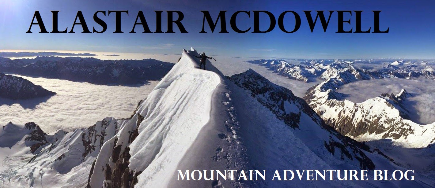
Scrambling around waterfalls in the lower Unknown Stream

The 1934 route taken by Burns & Townsend was entirely in the Canterbury Alps - "the icefalls, jungles and gorges of Westland were left severely alone." Their route crossed the landmarks of Whitehorn Pass, Unknown Col, Ragged Range, Rakaia River, Butler Saddle, Erewhon Station (food drop), Havelock, Forbes, Twilight Col, Godley hut (food drop), Classen, Tasman Saddle, Hermitage. Their trip took 12 days' worth of travelling time. A pretty good effort for the first traverse.

15 years later in 1949, McCabe and Morse decided to up the ante, considering that Burns & Townsend had taken a route quite far from the Main Divide at times, they took a route closer to the higher Alps. Instead of crossing low down in the Ragged Range they took Observation Col at the head of West Mathias. From the Lyell they sidled around McCoy Col, Rangitata Col, down into the Frances, then over Disappointment Saddle, skirting the edges of the Garden of Allah & Eden. Instead of Twilight Col, they took the higher Terra Nova Pass north of D'Archaic into the Godley Glacier, and from there the same route as Burns & Townsend to the Hermitage.

Over the next 50+ years dozens of parties have travelled a similar route to McCabe & Morse, most parties spending about 12-15 days with 1 or 2 food drops along the way.

Negotiating the Lyell Icefall

Modern Traverses

In the last 2 decades, the revered art of gravel-bashing has fallen slightly out of favour, with many more groups opting for detours into the wild West Coast valleys. This trend is perhaps also due to climate change rotting away the glaciers & snowfields of the Canterbury Passes to reveal yet more loose greywacke, and a desire for more remote wilderness travel offered by places like the Mungo, Whitcombe, Bracken, Gardens, Perth and Whataroa. These areas were made considerably more accessible from the 1960s onwards when deer culling huts, tracks and footbridges were established in many Westland valleys. Many of these huts have been adopted and revived by the Permolat 'Remote Huts' group. Detours to these wilderness areas doubles the length of the trip to 25-30+ days, due to slow gorge & bush travel and worse weather.

Sam crossing the Rakaia River

Folks have then pushed the boat out even further with traverses of the entire Southern Alps, some during tough winter conditions with skis in the mix. A few notable traverses which all of which stuck pretty close to the divide in the Arthur's Pass - Mt Cook section, and were milestones in their own ways are:

                     Graeme Dingle & Jill Tremain's 3 month winter traverse in 1971 - recounted in Dingle's book 'Two Against the Alps'

                     Craig Potton, Robbie Burton, Peter Burton and Paul Roy over the 1980 summer - recounted by Potton in his 2016 book 'So Far, So Good'

                     Steve Bruce and Warren Herrick in 1981 - an epic 5 month traverse entirely on the Western side of the Alps; one of the most accomplished of the traverses ever undertaken

                     Michael Abbot’s 1989-90 solo Southern Alps traverse was also a landmark trip, which broke the solo barrier

                     Richard & Kevin Ackerley's 'Pathway to the Setting Sun' in 1994, from the North Island's East Cape to the West Cape of Fiordland

                     Erik Bradshaw's Ski Traverse of the Southern Alps in 2011

                     Lydia McLean, Allan Brent, Alexi Belton completed a Te Wai Pounamu Traverse in 2016

                     Tom Hadley, Torea Scott-Fyfe, Maddy Whittaker, Conor Vaessen, Southern Alps Traverse in 2020-21

Criss-crossing the Main Divide certainly enhances the adventure with contrasts between East & West coast experiences, each with their own challenges. In 2013, three friends and I spent 33 days traversing one such Westland variation including walking the length of the Gardens to the Great Unknown and dropping into the Perth. This was one of my formative mountaineering experiences.

There have been many more creative traverses completed since. Climbing the highest peaks en route, skiing or packrafting through Fiordland. This type of DIY create-your-own-adventure is part of New Zealand's DNA.

The frequency of long traverses has increased also. In the 1980s there would be a major traverse every 3-4 years, then from about 2004 there have been trips almost every year. According to Shaun Barnett, that may be as much about people becoming inspired by previous stories, more easily spread via internet and social media, as it is by advanced equipment or new ways of travelling.

Lyell Icefall

Sport Alpinism

Though a central element of alpinism is the pursuit of virgin terrain and first ascents, there is also much to be said for repeating a great or historic classic and trying to improve on the original style. In the 2019 American Alpine Journal, Colin Haley describes what he coins Sport-Alpinism: "Sport-alpinism is essentially the art of creatively inventing new challenges when the most natural challenge—simply ascending the face of a mountain—is no longer difficult enough to truly inspire a climber or demand all of his or her skill. Climbing solo, climbing fast, traversing multiple peaks, enchaining multiple routes or climbing in winter are all dimensions of sport-alpinism."

In the theme of Sport-Alpinism, once the natural challenge of simply traversing from Arthur's Pass to Mount Cook was achieved, people have continued to push into new dimensions: winter - the ski traverses; harder terrain - the west coast traverses; distance - the entire Southern Alps and more; solo - Michael Abbot's 5-month odyssey. There is only one dimension that has not seen as much attention: speed.

How light & fast could you traverse from Arthur's Pass to Mount Cook? We wanted to find out.

Inspiration

After spending some time traversing more of the Canterbury valleys during a 3-week ski traverse in the spring and reading of all the history about those early expeditions, I became inspired to attempt a similar line focused more on the Canterbury ranges, but in a lightweight style. Instead of 33 days, as my first trip had taken, or 21 days as the ski version spanned, the goal was to complete the route in 6 days, crossing 6 passes between 6 major catchments.

Sam in the lower Unknown Stream

My companion was Sam Spector. He had contacted me for beta on a similar trip, so I convinced him to join me on the route I was scheming. All of a sudden it was on.

To achieve this, we needed to wait for a perfect forecast since any rain would put a crossing of the Rakaia, Godley or Murchison rivers in jeopardy. With the typical multi-week trip you can't pick your weather, you need to set a starting date and take what comes. But if the trip is short enough, you can wait for a good forecast. I think the ability to be flexible is a major key to success in mountaineering.

On McCabe & Morse's 1949 trip, of course they didn't have forecasts, so they walked into Carrington with 60 pound packs, only to be hut bound for the next 4 days in torrential rain, eating most of their food. Luckily, they had brought a rifle and over the next week subsisted on venison steaks, a Canadian goose, and hare soup. Folks had more patience and ingenuity back then.

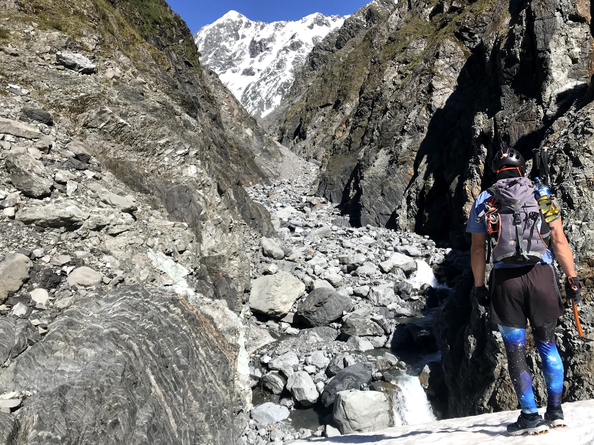
Thanks to Rakaia helicopters, we had food flown into Lyell Hut with the CMC hut building crew, and the same pilot took food into Mathias Hut with a load of hunters. I already had a stash in St Winifred hut, or so I thought - it was eaten by the time we got there! Three food drops for a six day trip meant only carrying 1-2 days of food at any time. Cheating? We waited for the elusive "6 day high" all through December, and finally it arrived. A full week of clear, calm weather.


Rangitata Col looking over the Gardens

On the saddle between Mt Tyndall and Mt Baker on the Gardens

The route

In general we chose a route similar to the early expeditions, taking variations for expediency and to explore different valleys. From the Waimakariri, instead of the common Harman/Whitehorn crossings, we decided to shoot directly over into the Burnet stream past Barker Hut. We followed the traditional Unknown Col into the Mathias and Observation Col into the Rakaia and arrived at Lyell hut in the evening of the third day to find the CMC hut crew busy at work on the new hut. We enjoyed a delicious 20 year old Speights that had been uncovered from the old hut, cooled by a nearby stream. Halfway in distance, but not in effort.

Up the emaciated Lyell glacier, we were able to go directly up the Lyell icefall amongst a jumble of seracs, a strange place to be in running shoes. From Rangitata Col we looked over the Gardens glistening and had no intention of dropping into the Frances glacier. With perfect weather we took the high route from Lambert Col over Tyndall & Newton, weaving around Perth Col and Schrund Punk to find an easy but exposed traverse (for running shoes) to Disappointment Saddle. It was a glorious line; we were quite fortunate to be there.

Over the Garden of Allah

Eating a hot meal in St Winifred's hut

Having crossed Terra Nova a few months prior, we chose a different crossing to the Godley, this time up the Forbes and over Twilight Col, leading us directly to Eade Memorial Hut. Now into five days of high pressure, the rivers were all low and the air was warm. We followed the footsteps of the Alpine Kids over Mt Acland into the Aida Glacier, feeling the burn, but it was all downhill from here right? Wrong. The long tumble of moraine down the Murchison Glacier would gift us a further 1200m additional vertical to test our resolve. 

At the head of the Murchison Lake

At the end of one of NZ’s greatest moraine bashes we were grateful to find food in Liebig hut as all we had left were sweet chili coated peanuts. Long trips are not meant to end easily, confirmed by the endlessly undulating crossing of the Tasman moraine and Husky slip. Walking out beneath the towering Caroline Face of Aoraki reassured us that we had arrived in Hermitage country, bringing one dream to an end.

Welcome to Aoraki / Mt Cook village

Final Words

There is something beautiful about choosing your own path, your own style, like an artist painting a deft red line through a topographic canvas, and the evolution of traverses between Arthur's Pass and Mount Cook and beyond is testament to this. Those early expeditions were explorations of the land, today they become explorations of the mind. What is possible?

The route


In summary the route taken was:

Day 1: Klondyke Corner - Waimakariri River - Carrington Hut - White River - Barker Hut - Col above pt 1529 - Burnet Stream - Wilberforce River - Unknown Stream Hut (40km/1700m)

Day 2: Unknown Stm. - Unknown Col - North Mathias River - Mathias Hut (food drop) - West Mathias Biv (29km/1500m)

Day 3: West Mathias - Observation Col - Cattle Stream - Rakaia River - Mein's Knob - Lyell Hut (food drop) (31km/1900m)

Day 4: Lyell Gl. - Rangitata Col - Lambert Col - Mt Tyndall/Newton Peak - Schrund Peak (col to east) - Disappointment Saddle - Havelock River - St Winifred Hut (34km/2900m)

Day 5: Havelock R. - South Forbes - Pt 2094 - Separation Stm. - Godley River - Eade Memorial Hut (27km/1600m)

Day 6: Eade Memorial - Mt Acland - Aida Gl. - Murchison Gl. - Tasman Gl. - Ball Road - Mt Cook Village (51km/2600m)

Total: 200km distance, 12,000m elevation gain.

Strava route

Gear for the trip


Monday 26 October 2020

Aoraki/Mt Cook via Sheila Face and Mt Tasman via Syme-Silberhorn

It was an awesome turn-out to the CMC Empress trip organised by Ben Mangan. Five days of fine weather saw Empress almost full with 8 people in the hut at one time. Thanks to good snow coverage on the Hooker, access was relatively quick via true-right of the icefall, 9 hours from Wyn Irwin to Empress.


Aoraki/Mt Cook via Sheila Face, Central Buttress

As it was October, mid-spring, we had planned to climb one of the ice routes on the Sheila. Upon reaching Empress, we could see the rock was warm and dry, and the ice nowhere to be seen. 4am the following morning we set off for the Central Buttress.


A sudden whoompf in the snow-pack put us on edge as we approached Fyfe gut, we pitched the glacier edge to the start of the rock to stay safe. The climbing was moderately gripping at first, some mixed conditions forced us to climb the slabby rock in crampons. ‘Grade 12’, but with a serious feeling.

After a few pitches we started to romp, carefully negotiating the verglassed rock now without ‘pons, simul-climbing and stretching the rope. At 2/3 height we took the offer of ice gullies to the south of the Central prow, enjoying consistent & sustained moderate terrain all the way to the summit ridge, topping out 30m from the high peak at 4pm.

The Linda was so well filled in we didn’t even need a rope, and we wandered into Plateau Hut at 830pm greeted by Gavin Lang, Sooji Clarkson and a host of others.

Mt Tasman – Syme-Silberhorn Traverse

I have long stared at the glistening east face of Tasman from Plateau hut and admired the classical snow ridges Syme and Silberhorn protruding down from the pointed summit. After the fantastic climb up and over Aoraki from Empress, we enjoyed a rest day in Plateau. But there was still 2 days of good weather remaining. Why don’t we attempt an ascent of Tasman? As the day of feeding progressed, our calves felt replenished, and at 4AM the next morning we were rearing to go with light packs bound for Tasman.

We negotiated daunting crevasses through the mad-mile and found a good schrund crossing on the rightside of Syme to reach the main snow arete in time for the morning alpenglow. This was the definition of aesthetic.

At the North Shoulder junction, we deemed it safer to climb straight up a nose of bulging ice rather than traverse avalanche-prone slopes across the east face. From here onwards we had astounding views over the West Coast Neves. The ridge narrowed to a razor-sharp edge, we elected to rope up.

Andy straddled the sastrugi ridge with his legs and the rope flaked between the east & west coast, and we ran a 200m pitch to the glorious summit.

The descent was harder than the ascent, hard swinging into blue ice on the Silberhorn Arete. I was grateful for sharp points. I had never simul-down-climbed before, but it felt like an efficient method for this section all the way to Silberhorn, with one abseil down an ice cliff. The Silberhorn rock-step was nasty, 3x 30m abseils led us through horrendous loose rock with just enough ice for v-threads. 12 hours return to Plateau.

We walked out the following day via Cinerama/Boys Glaciers, and instead of taking garbage gully to Ball Hut, we walked all the way to the Tasman terminal lake, then up through the gut of Husky Flat slip. 7.5 hours to Ball carpark. It’s a toss-up which way is faster between this, the scree slope above Husky Flat. The fixed ropes around Husky Flat might still be an option. At least the good news is walking in & out of Plateau should still be feasible for the next while, one way or another, for those in seeking a complete mountaineering adventure.

Thursday 9 July 2020

Aspiring Southwest Ridge Winter Ascent

Having climbed Aspiring only during the driest parts of summer, I knew I needed to return to that mountain to climb it in snow and ice. Especially since I’ve failed twice to climb the South Face and SW Ridge.

This year, early season conditions seemed fruitful, so I headed up to French Ridge hut with OUTC afficionados Tom Hadley and Owen Daniell. Skis and boots extrapolated from our packs, crossing bridges up the Matukituki and dodging branches up the French Ridge becomes an extra challenge.

We had a spare day in our schedule before the perfect summit day weather arrived, so we used this as a chance to tour up towards the Quarterdeck and reccie the approach. It’s always good to have this “acclimatization” day when you can afford it. You’re better rested, less stressed, and in tune with the mountain before launching off in the dark to your route.

Staying several nights at French Ridge Hut highlighted how poorly designed this hut is, receiving almost no sunlight in winter during the day, while the locked, empty wardens quarters is bathing in sunshine. NZAC or DOC should rotate this hut 90 or 180 degrees. My watch recorded 0 degrees C inside the hut during the middle of the day. Still, we preferred using the hut rather than an advanced base camp on the Bonar to keep things lightweight.


4AM departure from French Ridge had us at Quarterdeck well before dawn and the base of the SW ridge around 730AM. Instead of carrying enough water for the long day, we carried a Jetboil and brewed a few litres at the base while transitioning from ski-mode to climbing-mode, as dawn broke. This seemed efficient.


We were delighted to find firm, even icy conditions going up the lower ridge despite the concern of cross-loading from SE winds. The “crux” gully was in fat condition, with “hero” alpine ice all the way through a few short steps. Bring a #2 nut and #0.3 cam for the first anchor which can also be used for the exit section. 4-5 ice screws is plenty for this section, we got away with 3 but a few extras would have been nice. One 60m half rope will be more than adequate.


We reached the top about 2PM. As always the view from the summit of Aspiring was magnificent, especially with the winter snows. Tom Hadley had recently traversed the whole Snowdrift Range so he enjoyed retracing his journey from the short distance.


The Ramp had firm snow, and I mostly enjoyed my first descent of the notorious route, though I agree it does drag on for a while and you need to be constantly vigilant. It was amazing to hear later that Sam Smoothy had skiied the ramp in these conditions just the previous week.


Jumping across the ‘schrund just as the sun was dipping into the Tasman was an excellent way to finish the climb.


As we skinned back across the Bonar, the full moon appeared rising from directly behind the tip of Aspiring and at once headlamps were unnecessary on the moonlit glacier. Soon after, we spotted headlamps on the Coxcombe Ridge, approaching the summit. This was Ruari Macfarlane and George Loomes, nearing the end of their new route on the South Face.

Total time 17.5 hours hut-to-hut. 22km, 2500m vertical gain.

Saturday 7 March 2020

Mt Aspiring Northwest Ridge in a day


In the summer of 2014 I first climbed the beautiful peak of Mt Aspiring via the Northwest ridge. In this trip we spent four days in the park, up the waterfall rock slabs to Bevan Col, a 12-hour summit day on the NW ridge (though our original objective the North buttress was covered in snow), and return via French Ridge just to make it more interesting.

Fast forward 6 years, and I had started to realise what is possible in the mountains in light trail running shoes. I was sure Aspiring's NW ridge could be climbed comfortably in a day from the carpark, although I had not heard of anyone doing it. I teamed up with Hamish Fleming and Rose Pearson one weekend in late February 2020. We met up for dinner in Wanaka on the Saturday night planning to start early on Sunday hoping to be back in time for dinner, and drive back to Christchurch for work the next day.

In total the day is 57km with 3600m vertical gain. 18km of this can be done on a mountain bike to and from the Aspiring Hut from Raspberry carpark. The NW ridge is about 3km long with 1200m of height gain. So a lot of the gain and distance is covered on the approach. See the Strava route map here.

After the first 9km of biking on moderately rough farm tracks, you reach Aspiring Hut. This took about 45 minutes. From there we stashed the bikes just after the hut in the bush. From here there is a lot of runnable trail between Aspiring Hut and the base of Bevan Col waterfall slabs, great running. Its steeply uphill to Bevan Col for 850m height gain. The key to avoiding unnecessary scrambling is to stay low on the waterfall rock slabs, sticking close to the stream that runs down the gut. Higher up you'll need to traverse far enough right (east) to gain the slabs up to Bevan Col. You don't want to get blocked by firm snow in one of the troughs. 3:40 to Bevan Col from the Car.

Once over Bevan Col, in late summer the lower Bonar glacier is all white ice and incredibly grippy without crampons. We didn't think a rope was necessary as all crevasses are visible, just don't fall into one. It's fun hopping across the mellow ridges of white ice.

Colin Todd hut was bypassed to gain the Shipowner Ridge more expediently. This leads to Pt 2151m. Carefully traverse off the left side of this buttress about 50m below the top of the ridge that tops out at 2151m, sidling onto the top of the Therma Glacier. Here you can cut across the snow and gain the NW ridge proper. It's fun easy scrambling all the way up on the left side avoiding the major buttress.

Once we gained the top of the buttress it was bare rock slabs with faint avoidable snow patches all the way to the summit at an easy angle. Hands on knees grinding for 500m to the top. It was late February and we only took 3 steps on snow to reach the very top of Aspiring. We had carried an ice axe (Petzl Gully) and crampons (Petzl Leopard) but had not used them by this point. 6:40 to the summit.

It's still advisable to bring them in case you encounter more snow than anticipated. Climbing soft snow with the Leopard crampons in the midday sun softening the snow would be perfectly fine as its barely more than 30 or 35 degrees.

Below the Buttress on the descent, we used the Kangaroo snowpatch as a quick way to get back down to the Bonar. This is a snow field below the ridge which allows you to skip the time consuming route around Shipowner ridge, and bee-line it directly for Bevan Col, which was reached after 9 hours.

We started to hustle at this point hoping to finish in less than 12 hours (we all need an arbitrary time goal don't we?). After a hot run back down to Aspiring Hut we picked up the bikes and flew back down the hill to finish in 11 hours 51 minutes feeling pleased with a great day up and down one of the classic peaks.

We made it back to Christchurch at about 3am on Monday morning after a well spent weekend away.

Thursday 30 January 2020

Macpherson - Talbot Traverse, Darran Mountains, Fiordland

The Darran mountains of Fiordland are a land of sheer granite faces, streaming with waterfalls. Dense vegetation clings to the walls and snow caps the peaks. It is the wettest place in New Zealand, with metres of precipitation every year. As you drive into the deep-cut U-shaped valley, you feel like you're approaching the end of the world.

I've tried to make an annual pilgrimage to the Darrans every summer that I have been in NZ. The long multipitch trad rock climbing is exceptional. I made a visit this summer in late January with William Skea.

Our first climb was 'Finders Keepers' on Moir's Mate. 8 pitches with the final five being stacked in the 21-22 grade range. We simul-climbed the first 4 easier pitches in less than an hour using micro-traxions and Gri-gris to shorten the rope as we climbed. An excellent climb consisting of mostly friction climbing on slabs, with some interesting crack climbing near the end also. Mist swirled in and out obscuring visiblity creating an atmospheric ambience.


The weather was variable during the week, but staying in Homer Hut makes it easy to keep a close eye on the weather - just look out the window.

One day the weather was due to pack in during the early afternoon, so we decided to take on the classic Macpherson-Talbot traverse in the morning. It turned out to be an excellent half-day adventure thanks to a light-weight 'trailpinism' style.

The Macpherson-Talbot traverse is an excellent route beginning up rocky slopes to Homer Saddle, where the infamous 'Talbot's Ladder' begins. Its easy scrambling, less than grade 10, but it is exposed. Its best to attempt this section in dry conditions. For us the rock and vegetation was slightly damp, but the rock has good friction so just take care. We didn't feel the need for a rope, but that's a matter of preference. There are metal poles on the ridge that can be used as protection if you are using a rope.

Above, snow slopes lead to Macpherson. The snow-pack was thoroughly water logged and quite firm. I used La Sportiva Bushido II shoes combined with Petzl Leopard aluminum crampons. This offered excellent purchase in the snow. I carried a Camp Corsa aluminium ice axe in case I needed to self arrest. William used Salomon running shoes combined with Kahtoola Microspikes and he also found sufficient grip on the snow, as it is fairly low angle throughout the traverse. He carried a Petzl Gully ice tool in case of self arresting only. It is the sort of terrain that would go well with hiking poles - but ours were stolen by Kea the day before!

From Macpherson to Talbot the way involves sidling on high snow slopes, but it is also possible to spend time on the rocky ridge depending on snow coverage. Here the Microspikes excelled as they are so much quicker to take on and off, whereas the Leopard crampons slowed me down on transitions. This showed the trade-off between grip and transition time.

By now the weather had thoroughly packed in, but determined to reach the summit of Talbot to complete the full route, we continued in increasing rain along the scrambly ridge. Some excellent scrambling and views would be had here in drier conditions. We reached Talbot in total white-out, followed by a quick celebration, and turned around to head back down to Traverse Pass.

From there its a quick descent via snowfields to Gertrude Saddle where you pick up the popular cairned trail back into the valley to Homer Hut.

Once on the defined trail below the rock slabs, we hooned down the valley as fast as possible for a final time of 4 hours 15 minutes at Homer Hut. Every loop needs a defined starting and finishing point. We chose the toilet. Enjoy this short video of the highly recommended Macpherson-Talbot Traverse, one of the best alpine day trips in New Zealand.


Tuesday 14 January 2020

Mount Cook Grand Traverse in a day

Inspiration
Spending time in Europe, I was fascinated by the speed records set on the classic peaks of Mont Blanc and the Matterhorn, both by Kilian Jornet in just under 5 hours and 3 hours each, blisteringly quick times. I also loved that the de-facto style was to start in the early hours from the church at the centre of town, race up to the summit, and run back to the church to finish. A nice symmetry made possible by the proximity of European towns to the high peaks.


I tried this myself: Mont Blanc via Gouter from the church in Les Houches, and Matterhorn via Hornli from the church in Zermatt. You witness rapid changes of eco-systems as you gain height: from urban to forest to rock to snow, and all again in reverse as you race back down from the summit to the valley in a matter of hours.

It was an exhilarating experience and returning to NZ I dreamed of replicating this style on our own highest peak. Aoraki - in a day.


Previous climbs
In 2014 I climbed Aoraki/Mt Cook via the Linda with Elisha Nuttall, then in 2015 I climbed ‘White Dream’ on the South Face with Michael Eatson & Tawny Wagstaff. From a bivvy at the toe of the West Ridge it took us 20 hours to climb the south face and traverse from Low Peak to the infamous ‘Middle Peak Hotel’ – a deep crevasse in the mountain where we slept, at 3500m.

The following day it took 7 hours to traverse just 1 kilometre of icy ridgeline to the high peak. The ridge was hard ice and riddled with blobs of sastrugi – shards of ice - insecure enough to warrant using the rope. The rope made it marginally safer, but all the more time-consuming and exhausting spending extra time on the front points. I spent the following day in the hut peeling layers of burnt skin from my face. The whole trip from car to car took us 6 days.

Sunrise from the Hooker Valley


Route choice
For our one day trip, we had originally thought of climbing the Sheila Face from the head of the Hooker glacier, but recent snowfall meant the upper rock face might still have been icy so we opted for a pure snow-ice route.

The most aesthetic and logical route Rose and I could dream of was a full circuit, traversing the three peaks from the Hooker and returning via the Tasman. That's up the Northwest Couloir to Low Peak, along the top, down the Linda, and out via Cinerama Col and Ball Road. To complete the loop was a final 9km of tarmac and gravel back round to the Hooker Valley carpark. A total distance of 53km and 4000m of vertical gain.

Although we could have stashed a bike we decided the purest style was to complete the whole trip on foot, carrying the pack start to finish and no pre-caching of gear.

Rose climbing the icy NW Couloir

Preparation
Unlike running races, there’s no set date for a Mount Cook climb so you always have to be ready when the weather window arrives. But in the month or so beforehand we built up the fitness on progressively longer runs in the mountains with lots of vertical gain, things like the Manakau-Uwerau traverse, Three Passes in Arthurs Pass, and the Tararua SK traverse. These missions also helped work out the type of foods I could handle eating for 24 hours straight. Previous experience of 24-hour rogaines and Godzone adventure races also helped.

History
The Grand Traverse from Low to High peak was considered in its day one of the most impressive feats of world mountaineering, that is, in 1913. It was first done by cutting steps across its length and without crampons.

Emmeline Freda Du Faur with Alec and Peter Graham
Freda du Faur, first woman to climb Aoraki/Mt Cook in 1913 with guides Peter & Alec Graham
Ref: MNZ-1296-1/2-F. Alexander Turnbull Library, Wellington, New Zealand

But the shape of the ridge has changed drastically over the last decades, including the 1991 collapse of the high peak, and even changes shape year to year as it is battered by storms from the west. There are many ways up to the Low Peak; the West Ridge, South Face, Caroline Face. These are all more technical routes. We chose the easiest and therefore fastest route up, the Northwest couloir.

Adventure
What excited us most about this trip, like any true adventure, was the thrill of the unknown. We didn't know whether we would by stymied by difficult glacial passage past Pudding Rock in the Hooker valley or slowed to a halt by blue ice on the summit ridge. The conditions are ever changing around each storm cycle and so hard to predict. Even the recent huge washout at Husky Flat on Ball Road provided a question mark. And could it all be done back to the Hooker in 24 hours?

Reaching the West Ridge of Low Peak

Altitude
There was no single ‘crux’ as it turned out, it was a challenge of endurance. As I’ve often experienced with other rapid single push ascents, sleep deprivation and altitude sickness can be a toxic combination. With only 2 hours sleep before our midnight start and rising from sea level to 3000m in about 15 hours, I started to feel quite dizzy as we made our way up to Low Peak. We had not factored any acclimatisation into the compact schedule. This dizziness was compounded by blazing sun and no wind on the summit ridge, glorious yet dehydrating conditions. I was glad to have plenty of electrolyte drink to gulp down as I traversed the ridge, accessible on the front pockets of my Macpac adventure racing vest-style pack.

Nearing the end of the Grand Traverse

Navigation
The most difficult route finding is on the descent, navigating the scree and moraine between the Buoys glacier and Ball hut. We were bluffed out numerous times before we finally found the access onto the huge scree slope down to the Tasman moraines. We lost an hour here. Climbing up the loose lateral moraine to Ball Road is also tricky. You’re 20 hours in and have to rack your tired brain to remember the correct route up the sea of choss.

Gear
20L running vest style packs.
Running shoes (LS Bushido II) for the approach + running socks
¾ shank boots (LS Trango Tech) for the snow + mountaineering socks
Mini gaitors
BD sabretooth 12-point steel crampons
One Petzl Gully axe and one BD viper
Leki trail stick poles with snow baskets
A ski mountaineering harness (BD Couloir)
60cm dyneema sling each (tether)
40m of 8mm Beal Ice Line
4 aluminium ice screws with one Camp nano snap biner for each
Belay device + prussic + carabiners
Petzl Meteor helmet
Headlamp
A one-piece thermal vest suit
Macpac t-shirt
Macpac Prothermal
Macpac transition rain jacket
Macpac dash gloves
Spring energy gels
OSM bars
Fried bacon
A bag of cereal and protein powder
Tailwind electrolyte & energy powder for water
Two 500ml soft flask bottles for pure water and electrolytes
Two 750ml water bladders for refills to make 2.5L total
PLB (personal locator beacon)
First aid kit
SOL emergency bivvy bag
GoPro for filming.


I love my ‘onesie’ thermal suit: integrated fleece leggings and vest. My version of racing lycra. This is my default base layer for winter climbing, but in summer it’s the perfect warmth on its own without softshell pants. Having no extra baggy layers on the legs makes you feel like you can move twice as fast.

The Petzl Gully ice axe is an amazing lightweight tool. It feels weightless (280g) yet still penetrates ice and has a moveable hand-rest to adjust depending on the steepness. Next time I would climb with just two of these.

Light & Fast style
It’s about moving quickly but more so efficiently. Compressing a huge adventure into a short time frame increases the intensity. A shot of whisky rather than a pint of beer. It’s also about progression, improving on your previous style of ascent.

Going light enough allows you to go fast enough to enter the realm of a single push, and suddenly you can forego all overnight gear, clothing, extra food. Suddenly you can move really fast. That opens up so many options and allows you to take fuller advantage of short weather windows. It’s a useful tactic in harsh places like Patagonia.

But since this style has a lower safety margin in terms of being caught out in a storm, we make sure to only travel this way in perfect weather. The climbing itself actually becomes safer because you are less encumbered by a heavy pack and feel fresher. We still carry just enough gear to pitch out an icy section - a 40m rope and 4 ice screws in this case.


The style can be limiting though; there are many interesting routes further afield that require a heavier approach. Technical routes need more gear and more time. Both have their place.

Traversing the summit ridge of Aoraki/Mt Cook


Partnership
A small team makes logistics so much easier. If you’re trying to seize a short weather window mid-week around your job, efficiency of logistics is everything. Wasting an hour driving around could mean an hour’s less sleep. You’re operating on tight time frames.

Having a partner with similar goals and fitness on a trip like this is important. Rose and I have done a lot of previous climbing trips together, so we know how the other works and what we’re comfortable on.

On the High Peak after 13 hours from Hooker Valley carpark

In classical mountaineering you’re often simul-soloing most, if not all, of the route, so it’s important to have equal skill levels. If one person is much more confident than the other, they might be inclined to solo a more difficult section rather than bother getting the rope out, which will pressure the more inexperienced person to also follow without the rope. That can be a dangerous situation if not managed properly.

Aoraki is still a very special peak and the experiences I’ve had on this mountain rank alongside anything else I’ve found overseas. It’s inaccessibility and fickle, difficult-to-predict conditions ensure it’s never an easy tick. That makes it all the more satisfying.

Midnight, back at Wyn Irwin. A little scorched.


Wednesday 1 January 2020

Tararua SK Main Range

Ever since I read Graeme Dingle’s story, 10 year ago, of his 18 hour run along the length of the Tararuas back in 1965, I have been inspired by the “S-K”. It is the epitome of NZ adventure: a pure line, committing - no easy options for retreat, rugged terrain, an extreme distance and a savage amount of vertical.

While the South Island has been gifted the spectacular Southern Alps, they cannot compete with huge swaths of runnable ridgelines that the North Island has to offer, and this is where the Tararuas excel.


I had only completed one run here before – Otaki forks to Mt Hector, in full clag & rain - so I was looking forward to finally seeing the Tararua range in the flesh. This was the place where my mother and her siblings were raised tramping every weekend against their wills, now I had to discover it for myself.


My preferred style of mountain running outings lately has been: solo, lightweight, spontaneous. This style brings extra risk, so picking a good weather forecast is key, as well as emergency survival gear, communication & navigation devices, sufficient calories. Solo & spontaneous allows simplified logistics especially for picking the perfect day of weather. I only decided on the SK 9 days earlier as New Year’s Day dawned brightly on the Metvuw horizon.


But as reward, nothing compares to flying, unhindered & alone across a crisp ridge, with the final objective of Mount Hector looming 50 kilometres away, a mere haze in the horizon. This magic view from the tops came around three hours in, from the peaks of Mt Dundas and friends. I didn’t want to stare too hard into the distance for fear of being overwhelmed.

I had started earlier that morning at 3:30am, buzzing with anticipation. You can always count on your intuition to let you know if you’re ready for a challenge. Grateful to friends Felicity, Tom & Fergus for the early ride to the start, they also set off behind me to the Chamberlain Creek canyon from East Peak as I dissolved myself into the darkness.

After the pink sunrise cast by Australian bush fires, I pushed myself across the tops towards Arete, where I fell into the trap of trying to stay on target with other people’s published splits. This was a fun novelty for me, knowing how far ahead or behind a certain finishing time you were.

But it also proved to be dangerous in the hours before Dracophyllum Knob, where I realized I was low on water, and had failed to fill up at the few tarns along the way, concentrating on hitting splits at the expense of conserving myself for the long day ahead. Only carrying 1L of capacity was a big mistake, I should have carried 2L. This was no longer the South Island running I was used to, with either rivers or snow available everywhere to fill up on.

When I finally staggered into Drac biv I was already deep in a hole of dehydration that I would struggle for the rest of the day to climb out of. The beautifully clear, but blazing hot weather now showed its true cost – if only for a bit of clag & drizzle!

Dizzy in the heat, I dragged myself through the endless undulations of bush and peaks, amazed by the Tararuas’ inability to produce any flat ground.

Nicholls hut, Andersons hut, Maungahuka hut: I skulled as much fluid as I could, but almost immediately I would be back on the Tailwind, sucking it down like crack.

From this experience of strangely unquenchable thirst, in future I would bring more variety of powdered drinks and electrolytes to replenish both calories and salts in big hits when water fill-ups are all 2-4 hours apart. I carried 15 scoops of Tailwind powder which is excellent for while moving, but I would carry extra flavoured salt tablets specifically for encouraging drinking more at huts. Salt pills might also help for instant salt replenishment without required water. As would an extra 1L bladder...

A slightly alarmed tramper at Maungahuka generously made me a hot salty soup which made all the difference, especially while negotiating the exposed ridges of the famous Tararua Peaks with their fun sections of ladders and scrambling.


By now the sun was dipping, and a moist flow of warm air was gushing over the low peaks at the southern most part of the range before hitting Kime. With the cooler temps I was charging again and reaching the Southern Crossing was a big mental boost, although I knew at least 6 hours still remained.

There were some awkward exchanges with trampers at the hut, curious about the size of my pack as I quickly downed a bag of cereal & protein powder with some canola oil that I found in the hut.

“Just up from the Forks?”
“Nah, from Putara.”
“Where’s that?”
“Up in the northern part.”
“I don’t see it on my map…”
“Must be on the other map…”

From Mt Hector, that previously most distant peak, I now looked back to the north at the array of ridgelines leading north to Putara, seemingly floating on a bank of thick cloud pushing in from the west. It’s not often your days’ work is so evident in one sweeping view. What an inspiring range.


The Dress Circle’s smooth trails were an absolute delight and I reached Alpha hut at 930pm in good spirits, 18 hours after starting that morning. I had 6 hours to reach Kaitoke for the 24-hour mark and was confident of making it now.

But, I knew well of the horrors of the Marchant that lay below and looked forward to discover the hellish ridge for myself.

The nightmare began sooner than expected. My “fully charged” headlamp died barely an hour later. But I was prepared, with fresh AAA batteries. Computer says no. This new rechargeable headlamp does not accept replacement batteries.

A foolish mistake with only myself to blame. Fortunately, I still had 30% of juice remaining for my phone flashlight to guide me down the next 3-4 hours of Marchant Ridge.

I was now no longer chasing the 24-hour mark, but the rapidly falling battery level on my phone. I feared of being stranded in the dark bush with the dream slipping away…

So I flew through the bush with reckless abandon.

Another hour later and my fears of dehydration returned. Five hours on only 1 litre, what was I thinking? Soon I was searching every bog for a drinkable puddle of clear liquid. I was unbelievably thirsty.

I was ready to take the turn off to Smith Creek shelter and plunge myself into the Tauherenikau River, when at last a deliciously stagnant puddle appeared across the track. I gulped that down, and took some for the road. Giardia could wait, Kaitoke was coming.

I hammered the final descent of Dobson Loop track and finally reached the famous Kaitoke carpark of glory.


It was 2am, 22 hours 25 minutes had passed. I collapsed into the black Mazda my uncle had left for me there and doused myself with hot chicken soup and Powerade. I was just glad I didn’t have to turn around and go back up the Marchant for a second lap. What a way to start 2020.

Gear used on traverse:


For more information, visit: https://tararuafkt.wordpress.com/

Download the GPX file

Big Sunday Runs Wellington Facebook Group - for organising logistics with local runners and joining a great NZ core running community.