What are your goals when you head into the
hills? Are they to enjoy freedom of movement through nature? If so, how can you
maximise your enjoyment of that movement?
For me, the answer is to search for the
lightest way to thread through the mountains. This has led me to explore
different gear and strategies than are normally taken, to move as lightly as
possible.
Even if the terrain is so rough that you
cannot run, the lighter you can go still allows for a faster walking speed on
all terrain, less time spent stopped resting during the day, and less muscle
impact so a quicker recovery time overnight. That means you can cover more
ground in less time.
Fastpacking is the name given to that
hybrid activity of trail running and ultra-lightweight tramping. It's very
popular in America and Europe owing to well-developed trail infrastructure, and
is slowly taking off in NZ, particularly along the Te Araroa trail.
Every piece of gear that you bring needs to
be examined and optimized. A ruthless & analytical attitude needs to be
taken. That applies to footwear, clothing, sleeping, food, water.
The first question is, do I need this?
Nothing weighs nothing. The next question is, is there a lighter option
available that still meets my basic requirements? Many savings can be made
without spending top dollar. If you’re going to invest in anything, it would be
a compact sleeping bag. This in turn enables a smaller pack size.
Now I will describe the gear I used on a 6-day
fastpacking trip from Arthur’s Pass to Aoraki/Mt Cook village that worked for
me. Adapt these ideas to your own packing style & preferences.
Footwear
La Sportiva Bushido II trail
shoes (305g) are robust on rocky terrain, scramble well, and rigid enough to
accept crampons for simple snow terrain. Bridgedale waterproof storm socks keep
my feet warm on icy river crossings and travelling through wet snow.
Clothing
Pick a good forecast so you can
get away with fewer clothes but adapt to the forecast so you can still handle
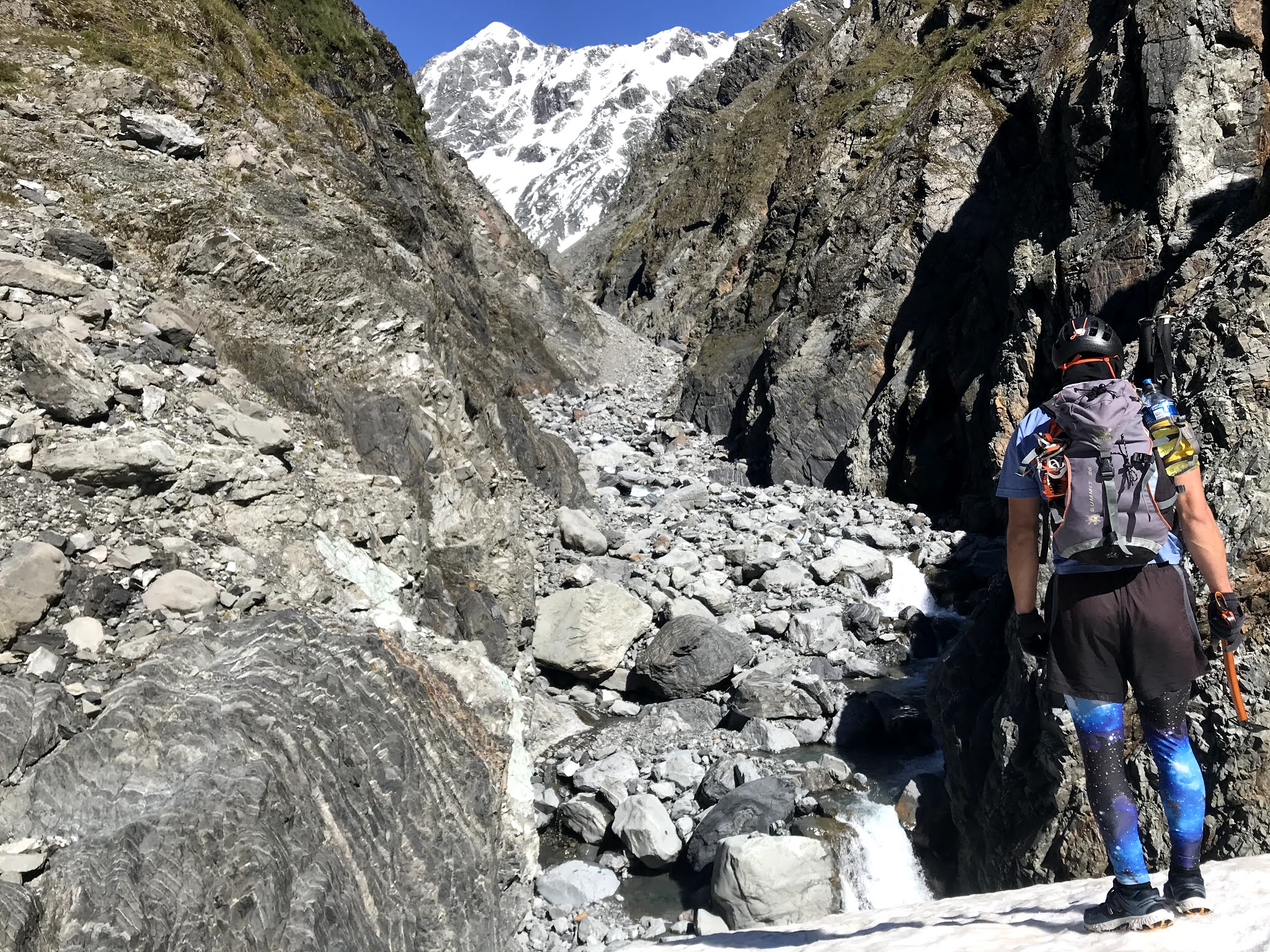
an unexpected storm. I use a Macpac Eyre T-shirt, Macpac hooded Prothermal,
Macpac Nitro mid-layer, Macpac Tempo rain jacket. For legs, Macpac Fast Track
shorts have handy waistline pockets and stretchy Macpac polypo/elastane
long-johns to pull over shorts when it gets cold. Thin Macpac Dash leather
gloves for scree & snow. Macpac Visor cap and Julbo Monte Bianco
sunglasses.
Pack
A new Macpac 15L vest-style pack
designed for fastpacking. Integrates features from trail running vests into a
pack large enough for multi-day trips. Large pockets on side and front mean all
your food and devices are within hands reach so you never have to stop. This
also makes it well balanced for running, with your gear well distributed around
you.
Water
2x 500ml soft flasks in front
pockets – I add GU electrolyte tablets to one and keep fresh water in the
other. Easy to fill up in streams and never carry excess water like you do with
a large reservoir.
Sleeping
Macpac Firefly 200 ultra-light
sleeping bag (370g) with compression stuff sack (46g). The lightest setup I
have found, as there are no zips and contains high quality down, yet still
plenty warm enough for sleeping in huts in summer, especially with a fireplace.
Poles
Black Diamond carbon distance Z
poles (284g) – these fold into thirds, attach to the front of the pack when not
needed for scrambling, but I use them for the vast majority and find them
extremely helpful.
Alpine
if venturing above the snowline, I bring a Camp Corsa aluminium ice axe (205g), Petzl Leopard FL aluminium crampons with dyneema cord linking system (384g) or Kahtoola Microspikes (372g), Petzl Sirocco helmet (170g). If simple glacier travel is involved, 10 metres of 6mm dyneema cord, harness (120cm dyneema sling + 1x locking carabiner). Ensure you have adequate experience for alpine terrain if taking minimal gear.
Food
Radix dehydrated meals – high fat content from coconut oil means lots
of calories for less weight. Bring 2 of the foil packets (breakfast + dinner)
and re-package all others in compostable bags to reduce trash on the trip.
Other food items include fruit leather, salted nuts, jerky, crackers,
dehydrated hummus, home-made energy bars, GU Roctane powdered fuel mix, chocolate
milkshake powder (premix milk powder, cacao powder, sugar in a compostable
bag). As the intensity on a fast-packing trip is in the ultra-endurance
category, fats and protein are as important as carbohydrates to provide the
amount of calories necessary for long days and for overnight recovery.
Cooking
Aluminium 450ml pot (50g),
Home-made Methylated spirits coke can cooker (10g), plastic bottle of
methylated spirits (30ml per person per day). 1 tablespoon of methylated
spirits heats up 2x 450ml pots of water for a dehydrated meal & hot drink.
However, most huts have a fireplace and a billy or pots which you can use to
heat water, so it may well be possible to leave all cooking gear behind and
still enjoy a hot meal – just do some research!
Eating
Instead of a bowl or cup, I eat all
my meals from 2 Radix pouches. I assign one pouch for salty (soups, dinners)
and the other for sweet (tea, coffee, chocolate milk, protein shakes,
breakfasts). These are easy to clean by adding some water and shaking them
around. Seal and fold the top and it makes a great shaker for powdered drinks!
Electronics
Phone, doubles as topo map
(NZTopo app) and camera. Petzl Actik Core headlamp (6-450 lumens), USB-rechargeable.
To charge these, a compact Cygnett 5000mAh battery bank (110g). Coros Vertix
GPS watch helps with navigation and has incredible battery life - I GPS tracked
the entire route on UltraMax longevity function and the battery lasted the
entire trip with 60 hours of GPS tracking.
Emergency & Miscellaneous
PLB, first
aid kit, SOL bivvy bag (130g). Always need backup and shelter even on
lightweight missions. Half bamboo toothbrush. Skinnies concentrated sunscreen.
Gurney Goo anti-chafe gel. 3m strapping tape. Lip balm.
Final Words
Minimalism is knowing how much is just
enough. Be smart and don't cut the safety margins too fine, safety is first,
but with all outdoor activities there is a level of risk accepted. The lighter
you go, the more risk you are taking, so be sure to acknowledge the limitations
of your gear and operate within those boundaries.
There is something beautiful about choosing
your own path, like an artist painting a deft red line through a topographic
canvas. The variety of different routes between Arthur’s Pass and Aoraki
painted over the years by adventurers now lie testament to this. Those early
expeditions were explorations of the land, today they become explorations of
the mind. What else is possible?
Asked after a six-day non-stop adventure race through the mountains around Mt Aspiring, “Was it fun?” can only be answered with a certain amount of internal amusement. Such intense experiences in the mountains cannot be summed up into small packages that the uninitiated can easily understand. “Was it fun?” is a difficult question to even ask yourself, let alone explain to another.
The constant battle against the wet and the cold, sleep deprivation, injuries and full-body soreness that comes from pushing yourself to extremes through night and day does not reckon well against the contemporary definition of fun. It’s fun with a time-delay. Days, weeks, or even months later once the memory of suffering has faded, all that remains is something deeply profound.
Joy in the Mountains
But pure fun can be found despite the slog and the suffering.
The bliss of skiing un-tracked powder from Temple Col in Arthurs Pass.
The thrill of swinging an axe into alpine ice with a resounding thunk.
Emerging from a frosty snow cave in the Seaward Kaikouras to witness the sun breaking over the Pacific Ocean.
Topping out on an un-climbed granite wall in the Paparoa Ranges.
Staring out to the Milford Sounds from the summit of Sabre Peak in the heart of Fiordland.
Bum sliding frozen avalanche chutes down the Otira Slide of Mt Rolleston.
The joy of the perfect view from a hard-earned summit.
These moments are great, but it’s the moments that push us out of comfort zones and force us to search a little deeper that make a story worth telling.
Brushes with fatality
Climbing the sheer granite walls of Fiordland, the consequences of an error is no more real. Shaking on a smeary left foot and gripping the shallow flake, my partner carefully selected the smallest cam hanging from his harness and inserted the lobes into the damp, flaring crack. He clipped the rope through the slung carabiner. In the grips of the rock, he was now committed to the move. But one subtle adjustment of body weight was enough to upset the tender balance of climbing rubber traction and gravity. Feet cut, he plummeted.
I locked the rope tight, watching in horror as the cam ripped, and he continued falling out of view until the rope jolted taut. Then silence. Long mumbled groans broke the cold air of the Darran Mountains. He hobbled into view and beckoned me to bring him down, desperate to be lowered to safety. Rolling up his pants, I winced as yellow skin was now stained scarlet. More leg revealed more gore - a perfect V-gash two inches wide, skin stretched open to expose bloody tissue and bone.
Cuts and bruises heal in a matter of weeks or months, but how long does it take to rebuild the damaged mental tissue that comes by the experience of a damaging fall in the mountains?
Death is a reality of life. But does a personal brush against the fatality of the mountains persuade one to give it all up for the safety of something more secure? How close are we willing to step towards the edge before giving it all up?
I asked a dark figure crunching across the frozen glacier of the Grand Plateau if he had a spare set of batteries; my headlamp had run out. “Sorry mate, only double A’s… the moon’s about to come up, you’ll be right…” I could see the glint of the half moon rising above the Tasman glacier, and thanked them as the pair continued towards the East Ridge of Aoraki/Mt Cook.
As fate would prevail that day, it would turn out to be his last climb. He was an experienced mountaineer, but the mountains had rolled their dice that day. We had planned to ascend our country’s highest peak the following day, but after hearing the harrowing news of this man’s fall, our party of three was now split. Conditions were the best they had been all season. Continue to the summit, or pay heed to the signs?
A decision to be made now or never, mountains will always claim lives and logic says the risk tomorrow is no different from the risk today. The next day, we enjoyed the taste of our country’s highest summit. But it was not without much introspection.
Experience the real New Zealand
We’d spent a perfect winter’s day in Arthurs Pass climbing the steep and icy Crow face of Mt Rolleston. Later, I shared a photo of first rays piercing the jagged horizon as my friends traversed a narrow ice ridge above a sea of clouds; an inspiring scene. Somehow the photo made its way onto Reddit with the title: “Tired of politics? I present the real New Zealand.” Comments flooded.
“Why isn't the rest of New Zealand real? Some place only a tiny fraction of the populace has been is more real than the rest?”
Answers to this valid question were abstract at best.
“Because you're deluding yourself into thinking we're not a tiny population of mountaineers desperately clinging to existence on rugged peaks with very little in the way of proper shelter and sustenance. It's a common problem when people go mountain crazy. They start imagining things like grass, sheep, bucket fountains, political corruption, elections, cities, cars, posts on websites, and houses. You just have to accept that this is all a fantasy you're living out to escape from the harsh reality you exist in. You have to let go of the dreams of an idyllic existence and accept you live on a mountain, and there is only the mountain. You're not reading this, and I never typed it. The reality is, you're on a mountain. Accept reality. Accept the mountain.”
New Zealand is a relatively small country, amassed with a relatively large number of mountain and wilderness areas, yet only a statistical few manage to experience the raw beauty of the hills, let alone understand why others put themselves through such hardship. According to a recent Active New Zealand Survey, the participation rate of tramping is 9.7%, yet for climbing and mountaineering is almost unsurprisingly less than 1%. The pursuit of New Zealand’s high peaks will most likely continue to be a niche sport here – the gear and instruction can be expensive, the dangers are well publicised in the media, and the fun to suffering ratio can be hard to cope with at first.
Navigating the moraine and white ice of the Tasman Glacier in white-out, followed by climbing thousands of metres up loose rock and wet snow certainly drained us and forced us to ask questions, like “Why do we do this to ourselves?” We try to return ourselves an answer, but the reply is drowned out by the roar of another rock avalanche and serac-collapse in the chaotic Hochstetter ice-fall far below.
The summit: a paradigm shift
On the summit, there was a feeling of incredible remoteness and of being at complete mercy to the mountains as the sun glared, rich and golden in the western horizon, glowing through the dense clouds of an approaching storm…
The city that we’d left that morning could not have felt further away. Without exchanging any words, we knew we were experiencing a classical mountaineering moment.
"Many Canterbury men know that a
tough trans-alpine crossing can be a harder test of competence in unorthodox
travel and stubborn endurance than a deal of high climbing" - John Pascoe,
one of the fore-fathers of early Southern Alps exploration, in Unclimbed New
Zealand, 1939.
Starting up the Waimakariri River
The Canterbury Alps sprawling between
Arthur's Pass and Aoraki/Mount Cook are just made for trans-alpine trips. While
there are great peaks to be climbed in this region - Murchison, Evans &
Whitcombe, Malcolm, D'Archaic - the approaches are long and mundane. In my mind,
the best way to enjoy these mountains is a traverse. Pick a line that slices
through the golden upper headwaters, crossing the high alpine passes between
each of the major catchments. You are the artist of your adventure.
Mountaineering can sometimes become
obsessed with summits. Transalpine trips on the other hand embrace the core of
what mountaineering is about – being and moving in mountains. A transalpine
trip that completely avoids any summit and instead weaves an aesthetic line
through them makes a statement that achieving a summit is not always the point
of being there.
Now that our goal is about movement rather
than conquest, how can we maximise our enjoyment of that movement? For me that
is finding the lightest way to thread through the mountains. This has led me to
explore different gear and strategies to move as lightly as possible.
Fastpacking is the name given to that
hybrid activity of trail running and tramping. It's popular in America and
Europe owing to well-developed trail infrastructure, and is slowly taking off
in NZ, particularly along the Te Araroa trail.
Why not apply this style to transalpine
travel in the Southern Alps? Since transalpine trips generally involve simple
alpine terrain, some compromises in equipment can be made. Running shoes instead
of boots, aluminium crampons and a light axe, ten metres of cord with sling
harnesses and a 13L pack to ensure nothing excess is brought along. Trailpinism.
Extending this setup to multi-day traverses is the logical progression.
But first, we must look back to the past to
understand how to move forwards.
Early Expeditions
Grant Hunter in his book 'Who Was First?'
recounts that the first to explore the Southern Alps were the Maori, in the
search of a trading route for pounamu. Then came the European surveyors in
search of the best pass for a road (Arthur's Pass) in the mid-late 1800s.
Recreational trips didn't come until later, as clearly a lengthwise traverse
served no purpose in the age of development.
The first recorded trip from the
Waimakariri to the Tasman was in Christmas 1934 by Canterbury Mountaineering
Club (CMC) members Burns & Townsend. In their account, they acknowledged
man's innate desire to walk long distances even as fast land transport was just
taking off, and they heeded to a prophesy given by the very first 1932 edition
of the Canterbury Mountaineer: "Perhaps in future years a club party
will set their time and patience in a trip over the ranges between Arthur's
Pass and the Tasman Glacier".
Observation Col
Refuelling in Cattle Stream
So the concept of Arthur’s Pass to Mount
Cook has been a part of CMC lore since the very formation of the club. Back
then the Mount Cook village was just known as the Hermitage, after the historic
hotel first constructed in 1884, and provides a fitting destination to satisfy
one's cravings after a long journey.
The early eras of CMC trips were focused
mostly in the local Canterbury Ranges, as unreliable vehicles and rougher roads
made for much slower regional travel. Canterbury mountaineers embraced their
local mountains and knew their backyard like the back of their hand, without as
much distraction of further afield ranges or exotic overseas expeditions. The
Coronavirus pandemic now pushes us back to this former time where travel
opportunities are limited and combined with climate change we also try to
reduce our travel-related carbon emissions. It is here we realise just how much
adventure is on offer in our local mountains.
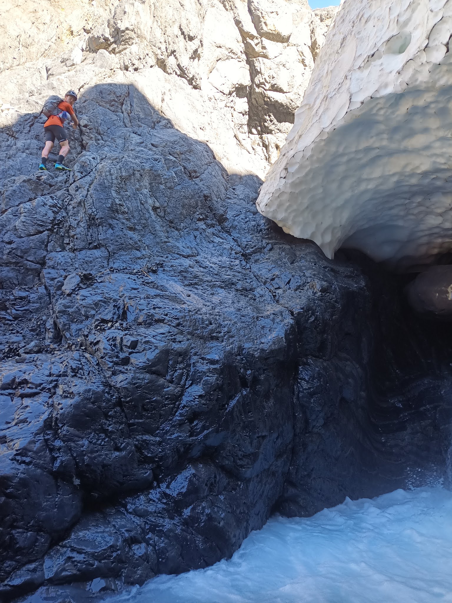
Scrambling around waterfalls in the lower Unknown Stream
The 1934 route taken by Burns &
Townsend was entirely in the Canterbury Alps - "the icefalls, jungles
and gorges of Westland were left severely alone." Their route crossed
the landmarks of Whitehorn Pass, Unknown Col, Ragged Range, Rakaia River, Butler
Saddle, Erewhon Station (food drop), Havelock, Forbes, Twilight Col, Godley hut
(food drop), Classen, Tasman Saddle, Hermitage. Their trip took 12 days' worth
of travelling time. A pretty good effort for the first traverse.
15 years later in 1949, McCabe and Morse
decided to up the ante, considering that Burns & Townsend had taken a route
quite far from the Main Divide at times, they took a route closer to the higher
Alps. Instead of crossing low down in the Ragged Range they took Observation
Col at the head of West Mathias. From the Lyell they sidled around McCoy Col,
Rangitata Col, down into the Frances, then over Disappointment Saddle, skirting
the edges of the Garden of Allah & Eden. Instead of Twilight Col, they took
the higher Terra Nova Pass north of D'Archaic into the Godley Glacier, and from
there the same route as Burns & Townsend to the Hermitage.
Over the next 50+ years dozens of parties
have travelled a similar route to McCabe & Morse, most parties spending
about 12-15 days with 1 or 2 food drops along the way.
Negotiating the Lyell Icefall
Modern Traverses
In the last 2 decades, the revered art of
gravel-bashing has fallen slightly out of favour, with many more groups opting
for detours into the wild West Coast valleys. This trend is perhaps also due to
climate change rotting away the glaciers & snowfields of the Canterbury
Passes to reveal yet more loose greywacke, and a desire for more remote
wilderness travel offered by places like the Mungo, Whitcombe, Bracken,
Gardens, Perth and Whataroa. These areas were made considerably more accessible
from the 1960s onwards when deer culling huts, tracks and footbridges were
established in many Westland valleys. Many of these huts have been adopted and
revived by the Permolat 'Remote Huts' group. Detours to these wilderness areas
doubles the length of the trip to 25-30+ days, due to slow gorge & bush
travel and worse weather.
Sam crossing the Rakaia River
Folks have then pushed the boat out even
further with traverses of the entire Southern Alps, some during tough winter
conditions with skis in the mix. A few notable traverses which all of which
stuck pretty close to the divide in the Arthur's Pass - Mt Cook section, and
were milestones in their own ways are:
•Graeme Dingle & Jill
Tremain's 3 month winter traverse in 1971 - recounted in Dingle's book 'Two
Against the Alps'
•Craig Potton, Robbie Burton,
Peter Burton and Paul Roy over the 1980 summer - recounted by Potton in his
2016 book 'So Far, So Good'
•Steve Bruce and Warren Herrick
in 1981 - an epic 5 month traverse entirely on the Western side of the Alps;
one of the most accomplished of the traverses ever undertaken
•Michael Abbot’s 1989-90 solo
Southern Alps traverse was also a landmark trip, which broke the solo barrier
•Richard & Kevin Ackerley's
'Pathway to the Setting Sun' in 1994, from the North Island's East Cape to the
West Cape of Fiordland
•Erik Bradshaw's Ski Traverse of
the Southern Alps in 2011
•Lydia McLean, Allan Brent,
Alexi Belton completed a Te Wai Pounamu Traverse in 2016
•Tom Hadley, Torea Scott-Fyfe,
Maddy Whittaker, Conor Vaessen, Southern Alps Traverse in 2020-21
Criss-crossing the Main Divide certainly
enhances the adventure with contrasts between East & West coast
experiences, each with their own challenges. In 2013, three friends and I spent
33 days traversing one such Westland variation including walking the length of
the Gardens to the Great Unknown and dropping into the Perth. This was one of
my formative mountaineering experiences.
There have been many more creative
traverses completed since. Climbing the highest peaks en route, skiing or
packrafting through Fiordland. This type of DIY create-your-own-adventure is
part of New Zealand's DNA.
The frequency of long traverses has
increased also. In the 1980s there would be a major traverse every 3-4 years,
then from about 2004 there have been trips almost every year. According to
Shaun Barnett, that may be as much about people becoming inspired by previous
stories, more easily spread via internet and social media, as it is by advanced
equipment or new ways of travelling.
Lyell Icefall
Sport Alpinism
Though a central element of alpinism is the
pursuit of virgin terrain and first ascents, there is also much to be said for
repeating a great or historic classic and trying to improve on the original
style. In the 2019 American Alpine Journal, Colin Haley describes what he coins
Sport-Alpinism: "Sport-alpinism is essentially the art of creatively
inventing new challenges when the most natural challenge—simply ascending the
face of a mountain—is no longer difficult enough to truly inspire a climber or
demand all of his or her skill. Climbing solo, climbing fast, traversing
multiple peaks, enchaining multiple routes or climbing in winter are all
dimensions of sport-alpinism."
In the theme of Sport-Alpinism, once the
natural challenge of simply traversing from Arthur's Pass to Mount Cook was
achieved, people have continued to push into new dimensions: winter - the ski
traverses; harder terrain - the west coast traverses; distance - the entire
Southern Alps and more; solo - Michael Abbot's 5-month odyssey. There is only
one dimension that has not seen as much attention: speed.
How light & fast could you traverse
from Arthur's Pass to Mount Cook? We wanted to find out.
Inspiration
After spending some time traversing more of
the Canterbury valleys during a 3-week ski traverse in the spring and reading
of all the history about those early expeditions, I became inspired to attempt
a similar line focused more on the Canterbury ranges, but in a lightweight
style. Instead of 33 days, as my first trip had taken, or 21 days as the ski
version spanned, the goal was to complete the route in 6 days, crossing 6
passes between 6 major catchments.
Sam in the lower Unknown Stream
My companion was Sam Spector. He had contacted
me for beta on a similar trip, so I convinced him to join me on the route I was
scheming. All of a sudden it was on.
To achieve this, we needed to wait for a
perfect forecast since any rain would put a crossing of the Rakaia, Godley or
Murchison rivers in jeopardy. With the typical multi-week trip you can't pick
your weather, you need to set a starting date and take what comes. But if the
trip is short enough, you can wait for a good forecast. I think the ability to
be flexible is a major key to success in mountaineering.
On McCabe & Morse's 1949 trip, of
course they didn't have forecasts, so they walked into Carrington with 60 pound
packs, only to be hut bound for the next 4 days in torrential rain, eating most
of their food. Luckily, they had brought a rifle and over the next week
subsisted on venison steaks, a Canadian goose, and hare soup. Folks had more
patience and ingenuity back then.
Thanks to Rakaia helicopters, we had food flown
into Lyell Hut with the CMC hut building crew, and the same pilot took food
into Mathias Hut with a load of hunters. I already had a stash in St Winifred
hut, or so I thought - it was eaten by the time we got there! Three food drops
for a six day trip meant only carrying 1-2 days of food at any time. Cheating?
We waited for the elusive "6 day high" all through December, and
finally it arrived. A full week of clear, calm weather.
Rangitata Col looking over the Gardens
On the saddle between Mt Tyndall and Mt Baker on the Gardens
The route
In general we chose a route similar to the
early expeditions, taking variations for expediency and to explore different
valleys. From the Waimakariri, instead of the common Harman/Whitehorn crossings,
we decided to shoot directly over into the Burnet stream past Barker Hut. We
followed the traditional Unknown Col into the Mathias and Observation Col into
the Rakaia and arrived at Lyell hut in the evening of the third day to find the
CMC hut crew busy at work on the new hut. We enjoyed a delicious 20 year old
Speights that had been uncovered from the old hut, cooled by a nearby stream.
Halfway in distance, but not in effort.
Up the emaciated Lyell glacier, we were
able to go directly up the Lyell icefall amongst a jumble of seracs, a strange
place to be in running shoes. From Rangitata Col we looked over the Gardens
glistening and had no intention of dropping into the Frances glacier. With
perfect weather we took the high route from Lambert Col over Tyndall &
Newton, weaving around Perth Col and Schrund Punk to find an easy but exposed
traverse (for running shoes) to Disappointment Saddle. It was a glorious line;
we were quite fortunate to be there.
Over the Garden of Allah
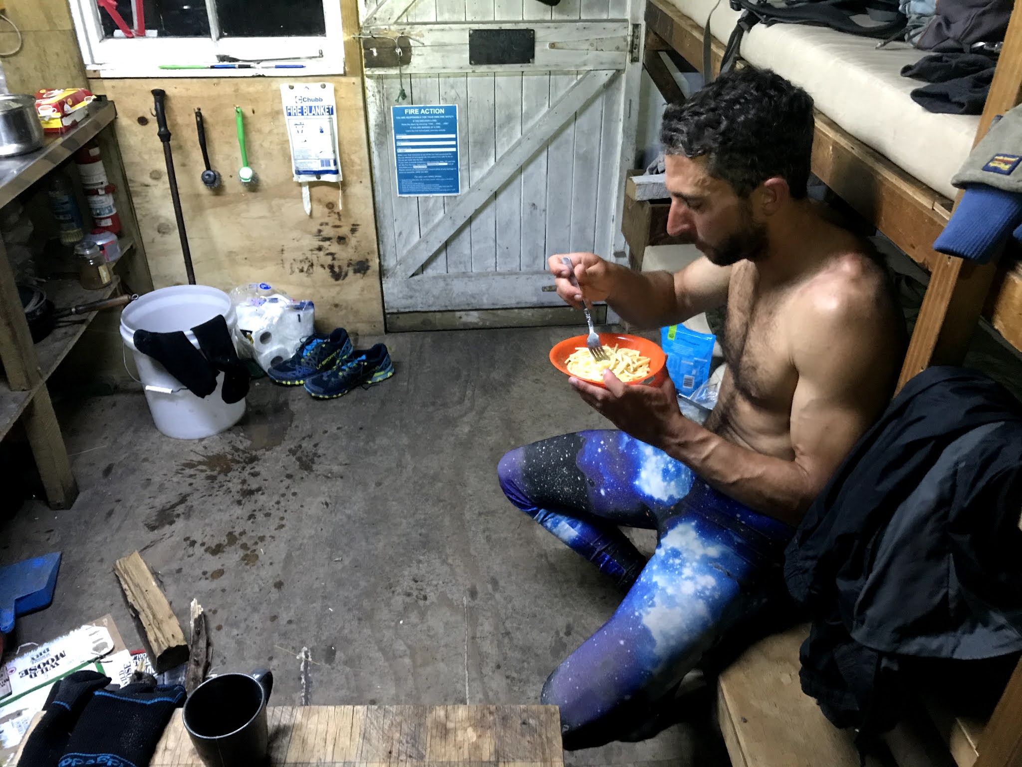
Eating a hot meal in St Winifred's hut
Having crossed Terra Nova a few months
prior, we chose a different crossing to the Godley, this time up the Forbes and
over Twilight Col, leading us directly to Eade Memorial Hut. Now into five days
of high pressure, the rivers were all low and the air was warm. We followed the
footsteps of the Alpine Kids over Mt Acland into the Aida Glacier, feeling the
burn, but it was all downhill from here right? Wrong. The long tumble of
moraine down the Murchison Glacier would gift us a further 1200m additional vertical
to test our resolve.
At the head of the Murchison Lake
At the end of one of NZ’s greatest moraine bashes we were
grateful to find food in Liebig hut as all we had left were sweet chili coated
peanuts. Long trips are not meant to end easily, confirmed by the endlessly
undulating crossing of the Tasman moraine and Husky slip. Walking out beneath
the towering Caroline Face of Aoraki reassured us that we had arrived in
Hermitage country, bringing one dream to an end.
Welcome to Aoraki / Mt Cook village
Final Words
There is something beautiful about choosing
your own path, your own style, like an artist painting a deft red line through
a topographic canvas, and the evolution of traverses between Arthur's Pass and
Mount Cook and beyond is testament to this. Those early expeditions were
explorations of the land, today they become explorations of the mind. What is
possible?
The route
In summary the route taken was:
Day 1: Klondyke Corner - Waimakariri River
- Carrington Hut - White River - Barker Hut - Col above pt 1529 - Burnet Stream
- Wilberforce River - Unknown Stream Hut (40km/1700m)
Day 2: Unknown Stm. - Unknown Col - North
Mathias River - Mathias Hut (food drop) - West Mathias Biv (29km/1500m)
Day 3: West Mathias - Observation Col -
Cattle Stream - Rakaia River - Mein's Knob - Lyell Hut (food drop) (31km/1900m)
Day 4: Lyell Gl. - Rangitata Col - Lambert
Col - Mt Tyndall/Newton Peak - Schrund Peak (col to east) - Disappointment
Saddle - Havelock River - St Winifred Hut (34km/2900m)
Day 5: Havelock R. - South Forbes - Pt 2094
- Separation Stm. - Godley River - Eade Memorial Hut (27km/1600m)
Day 6: Eade Memorial - Mt Acland - Aida Gl.
- Murchison Gl. - Tasman Gl. - Ball Road - Mt Cook Village (51km/2600m)
It was an awesome turn-out to the CMC
Empress trip organised by Ben Mangan. Five days of fine weather saw Empress
almost full with 8 people in the hut at one time. Thanks to good snow coverage
on the Hooker, access was relatively quick via true-right of the icefall, 9
hours from Wyn Irwin to Empress.
Aoraki/Mt Cook via Sheila Face, Central Buttress
As it was October, mid-spring, we had planned to climb one of the ice routes on the Sheila. Upon reaching Empress, we could see the rock was warm and dry, and the ice nowhere to be seen. 4am the following morning we set off for the Central Buttress.
A sudden whoompf in the snow-pack put us on edge as we approached Fyfe gut, we pitched the glacier edge to the start of the rock to stay safe. The climbing was moderately gripping at first, some mixed conditions forced us to climb the slabby rock in crampons. ‘Grade 12’, but with a serious feeling.
After a few pitches we started to romp, carefully negotiating the verglassed rock now without ‘pons, simul-climbing and stretching the rope. At 2/3 height we took the offer of ice gullies to the south of the Central prow, enjoying consistent & sustained moderate terrain all the way to the summit ridge, topping out 30m from the high peak at 4pm.
The Linda was so well filled in we didn’t even need a rope, and we wandered into Plateau Hut at 830pm greeted by Gavin Lang, Sooji Clarkson and a host of others.
Mt Tasman – Syme-Silberhorn Traverse
I have long stared at the glistening east face of Tasman from Plateau hut and admired the classical snow ridges Syme and Silberhorn protruding down from the pointed summit. After the fantastic climb up and over Aoraki from Empress, we enjoyed a rest day in Plateau. But there was still 2 days of good weather remaining. Why don’t we attempt an ascent of Tasman? As the day of feeding progressed, our calves felt replenished, and at 4AM the next morning we were rearing to go with light packs bound for Tasman.
We negotiated daunting crevasses through the mad-mile and found a good schrund crossing on the rightside of Syme to reach the main snow arete in time for the morning alpenglow. This was the definition of aesthetic.
At the North Shoulder junction, we deemed it safer to climb straight up a nose of bulging ice rather than traverse avalanche-prone slopes across the east face. From here onwards we had astounding views over the West Coast Neves. The ridge narrowed to a razor-sharp edge, we elected to rope up.
Andy straddled the sastrugi ridge with his legs and the rope flaked between the east & west coast, and we ran a 200m pitch to the glorious summit.
The descent was harder than the ascent, hard swinging into blue ice on the Silberhorn Arete. I was grateful for sharp points. I had never simul-down-climbed before, but it felt like an efficient method for this section all the way to Silberhorn, with one abseil down an ice cliff. The Silberhorn rock-step was nasty, 3x 30m abseils led us through horrendous loose rock with just enough ice for v-threads. 12 hours return to Plateau.
We walked out the following day via Cinerama/Boys Glaciers, and instead of taking garbage gully to Ball Hut, we walked all the way to the Tasman terminal lake, then up through the gut of Husky Flat slip. 7.5 hours to Ball carpark. It’s a toss-up which way is faster between this, the scree slope above Husky Flat. The fixed ropes around Husky Flat might still be an option. At least the good news is walking in & out of Plateau should still be feasible for the next while, one way or another, for those in seeking a complete mountaineering adventure.
Having climbed Aspiring only during the driest parts of summer, I knew I needed to return to that mountain to climb it in snow and ice. Especially since I’ve failed twice to climb the South Face and SW Ridge.
This year, early season conditions seemed fruitful, so I headed up to French Ridge hut with OUTC afficionados Tom Hadley and Owen Daniell. Skis and boots extrapolated from our packs, crossing bridges up the Matukituki and dodging branches up the French Ridge becomes an extra challenge.
We had a spare day in our schedule before the perfect summit day weather arrived, so we used this as a chance to tour up towards the Quarterdeck and reccie the approach. It’s always good to have this “acclimatization” day when you can afford it. You’re better rested, less stressed, and in tune with the mountain before launching off in the dark to your route.
Staying several nights at French Ridge Hut highlighted how poorly designed this hut is, receiving almost no sunlight in winter during the day, while the locked, empty wardens quarters is bathing in sunshine. NZAC or DOC should rotate this hut 90 or 180 degrees. My watch recorded 0 degrees C inside the hut during the middle of the day. Still, we preferred using the hut rather than an advanced base camp on the Bonar to keep things lightweight.
4AM departure from French Ridge had us at Quarterdeck well before dawn and the base of the SW ridge around 730AM. Instead of carrying enough water for the long day, we carried a Jetboil and brewed a few litres at the base while transitioning from ski-mode to climbing-mode, as dawn broke. This seemed efficient.
We were delighted to find firm, even icy conditions going up the lower ridge despite the concern of cross-loading from SE winds. The “crux” gully was in fat condition, with “hero” alpine ice all the way through a few short steps. Bring a #2 nut and #0.3 cam for the first anchor which can also be used for the exit section. 4-5 ice screws is plenty for this section, we got away with 3 but a few extras would have been nice. One 60m half rope will be more than adequate.
We reached the top about 2PM. As always the view from the summit of Aspiring was magnificent, especially with the winter snows. Tom Hadley had recently traversed the whole Snowdrift Range so he enjoyed retracing his journey from the short distance.
The Ramp had firm snow, and I mostly enjoyed my first descent of the notorious route, though I agree it does drag on for a while and you need to be constantly vigilant. It was amazing to hear later that Sam Smoothy had skiied the ramp in these conditions just the previous week.
Jumping across the ‘schrund just as the sun was dipping into the Tasman was an excellent way to finish the climb.
As we skinned back across the Bonar, the full moon appeared rising from directly behind the tip of Aspiring and at once headlamps were unnecessary on the moonlit glacier. Soon after, we spotted headlamps on the Coxcombe Ridge, approaching the summit. This was Ruari Macfarlane and George Loomes, nearing the end of their new route on the South Face.
Total time 17.5 hours hut-to-hut. 22km, 2500m vertical gain.
In the summer of 2014 I first climbed the beautiful peak of Mt Aspiring via the Northwest ridge. In this trip we spent four days in the park, up the waterfall rock slabs to Bevan Col, a 12-hour summit day on the NW ridge (though our original objective the North buttress was covered in snow), and return via French Ridge just to make it more interesting.
Fast forward 6 years, and I had started to realise what is possible in the mountains in light trail running shoes. I was sure Aspiring's NW ridge could be climbed comfortably in a day from the carpark, although I had not heard of anyone doing it. I teamed up with Hamish Fleming and Rose Pearson one weekend in late February 2020. We met up for dinner in Wanaka on the Saturday night planning to start early on Sunday hoping to be back in time for dinner, and drive back to Christchurch for work the next day.
In total the day is 57km with 3600m vertical gain. 18km of this can be done on a mountain bike to and from the Aspiring Hut from Raspberry carpark. The NW ridge is about 3km long with 1200m of height gain. So a lot of the gain and distance is covered on the approach. See the Strava route map here.
After the first 9km of biking on moderately rough farm tracks, you reach Aspiring Hut. This took about 45 minutes. From there we stashed the bikes just after the hut in the bush. From here there is a lot of runnable trail between Aspiring Hut and the base of Bevan Col waterfall slabs, great running. Its steeply uphill to Bevan Col for 850m height gain. The key to avoiding unnecessary scrambling is to stay low on the waterfall rock slabs, sticking close to the stream that runs down the gut. Higher up you'll need to traverse far enough right (east) to gain the slabs up to Bevan Col. You don't want to get blocked by firm snow in one of the troughs. 3:40 to Bevan Col from the Car.
Once over Bevan Col, in late summer the lower Bonar glacier is all white ice and incredibly grippy without crampons. We didn't think a rope was necessary as all crevasses are visible, just don't fall into one. It's fun hopping across the mellow ridges of white ice.
Colin Todd hut was bypassed to gain the Shipowner Ridge more expediently. This leads to Pt 2151m. Carefully traverse off the left side of this buttress about 50m below the top of the ridge that tops out at 2151m, sidling onto the top of the Therma Glacier. Here you can cut across the snow and gain the NW ridge proper. It's fun easy scrambling all the way up on the left side avoiding the major buttress.
Once we gained the top of the buttress it was bare rock slabs with faint avoidable snow patches all the way to the summit at an easy angle. Hands on knees grinding for 500m to the top. It was late February and we only took 3 steps on snow to reach the very top of Aspiring. We had carried an ice axe (Petzl Gully) and crampons (Petzl Leopard) but had not used them by this point. 6:40 to the summit.
It's still advisable to bring them in case you encounter more snow than anticipated. Climbing soft snow with the Leopard crampons in the midday sun softening the snow would be perfectly fine as its barely more than 30 or 35 degrees.
Below the Buttress on the descent, we used the Kangaroo snowpatch as a quick way to get back down to the Bonar. This is a snow field below the ridge which allows you to skip the time consuming route around Shipowner ridge, and bee-line it directly for Bevan Col, which was reached after 9 hours.
We started to hustle at this point hoping to finish in less than 12 hours (we all need an arbitrary time goal don't we?). After a hot run back down to Aspiring Hut we picked up the bikes and flew back down the hill to finish in 11 hours 51 minutes feeling pleased with a great day up and down one of the classic peaks.
We made it back to Christchurch at about 3am on Monday morning after a well spent weekend away.