|
| The classical Nelson Lakes view: Lake Rotoiti from St Arnaud |
Nelson - the top of the south. So its fair enough that it hosts the magnificent Nelson Lakes National Park - the northern-most strain of the Southern Alps.
Despite their grandeur, I couldn't find anyone to accompany me on the ambitious journey I'd set through the park this weekend. So I took to the mountains solo. No need to worry, I was well equiped, into my new 25 litre pack I stashed a sleeping bag, goretex jacket, a few thermals and plenty of food. A short ninety minute drive from Nelson to Robert Ridge, I left straight after work and was on the trail by 6pm - onwards to Speargrass Hut!
 |
| Crossing the Speargrass Creek bridge to the hut |
Stage 1: Robert Carpark -> Speargrass Hut (1hr15)
No time to lose, I was off. Still getting used to running with a 6-8kg pack on my back, I had a leisurely jog to the hut, sidling around the head of Mt Robert and alongside Speargrass Creek. The hut was perched in an open clearing of, surprisingly, speargrass - late evening cloud hung around the epic looking gulley towards Lake Angelus... I decided to call it a night here, and rest up for the big trek tomorrow.
 |
| Israeli Man saying goodbye at Speargrass Hut |
I shared a breakfast of
PowerBar muesli in a bag with an Israeli couple, and a British tramping family who were forever asking their son Thomas to kindly brush his teeth. Too bad I'd ditched mine - unnecessary weight! The water was so pure, my teeth were cleaned to mountain-stream fresh breath standard.
Stage 2: Speargrass Hut -> Sabine Hut (1hr40)
On the road at a spritely eight o'clock, I took to the gradually declining trail to Sabine Hut with gusto. I passed a few small forest tarns along the way, uniquely out of place. In the huge scheme of time, I cut through the still forest as a momentary blur.
 |
| Blue blur through the greenery |
Was this a great mass of blue sky appearing through the trees, or the huge still expanse of Lake Rotoroa? The air was still but for the irritating buzz of sandflies - I avoided being their morning tea and spent mine swimming in the lake. Cool and refreshing, I drank as I swam. The lake's surface coated in spongy moss gave my feet a good massage before moving on down the Sabine River.
 |
| Early morning bath at Rotoroa |
Stage 3: Sabine Hut -> West Sabine Hut (2hr30)
Travelling down the true right bank of the river made for an idyllic run. It felt like true South Island, open grassy patches with views down the river to the high 2000m peaks still holding snow at the tops. The track was mostly flat, except for a few "step-ups" as an Australian tramper put it, the trail was fast going helping me to cut the tramping time to West Sabine hut in half.
 |
| Cairns lead the way |
 |
| Taking a break by the river |
To cross the river though, not quite so easy! - the bridge had been smashed in a flood, and the warped wreckage was still hanging in the blue rush. Thanks to some local knowledge, I found a log conveniently lying across the river, which I waltzed across. As it turned out, this one broken bridge would affect almost everyone on the circuit and everyone planning to come in the next week - with big downpours forecast, the tame Sabine would soon become a raging, rising torrent.
 |
| Tricky traverse |
Stage 4: West Sabine -> Upper Travers (2hr50)
After a cramp relieving lunch with a fellow solo Swiss man, I braved the brutal climb ahead up to Travers Saddle. Still sucking down gallons of the sweet stream nectar, I realised I was over-hydrating when I started stumbling in a dizzy haze all over the trail. Too much of a good thing - I decided my blood electrolytes must have been diluted from all the drinking, so I rushed a sachet of Vitasport into my reservoir, along with a gel-shot of Leppin. I slapped my face together, and it made all the difference. December two years ago I was cruising down this steep scree slope with Rangitoto College tramping friends. What a challenge attacking the slope from this direction! Every so often I paused to catch my breath, but looking back to see where I'd come, my breath was instantly taken away....
 |
| Magical run |
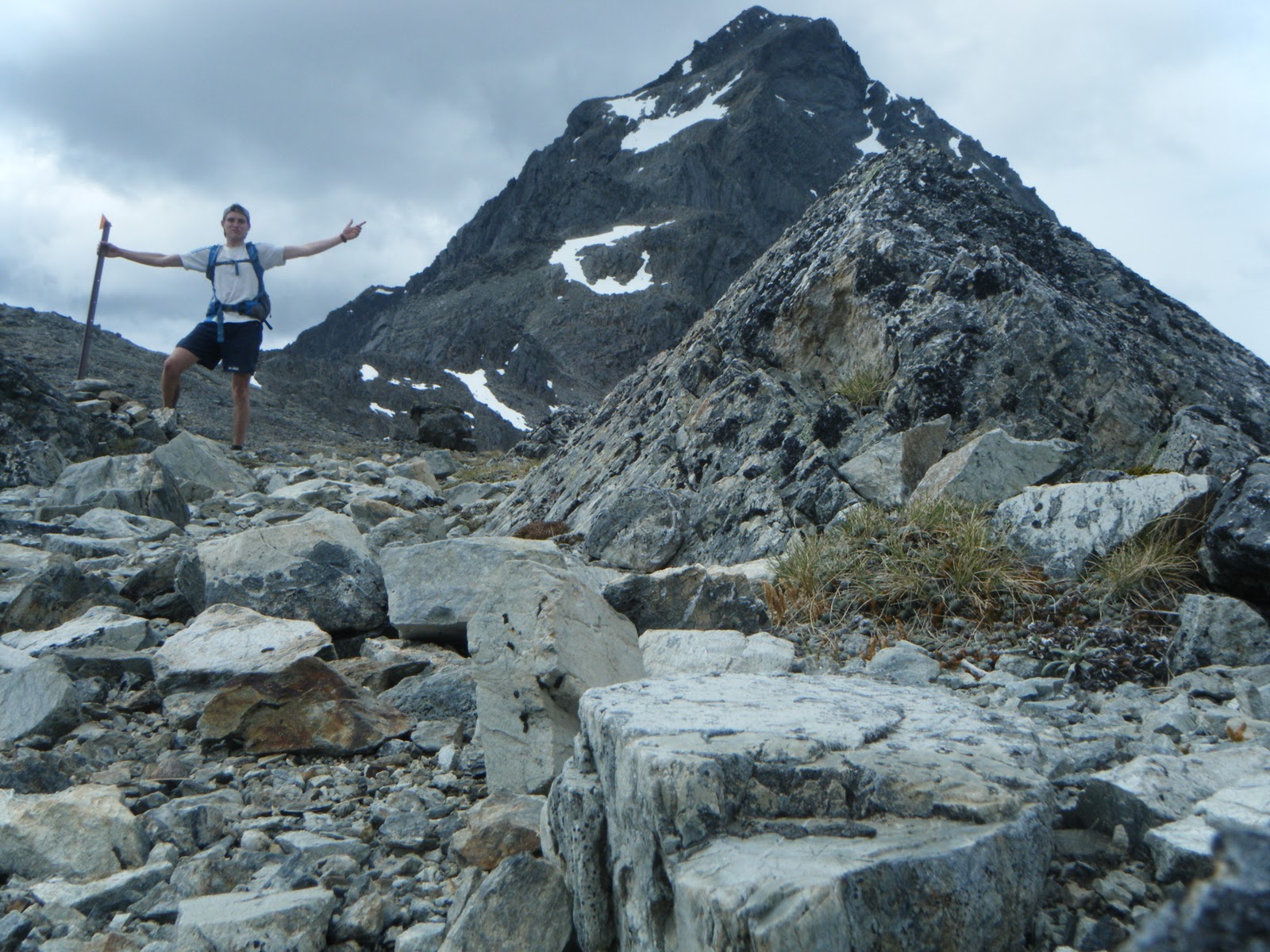
I reached the saddle at 4pm, exhausted but revelling. Mt Travers looked dangerous, a lot sharper than I'd remembered... Being alone high on a mountain pass made most things seem more extreme, although I was still in just a t-shirt and shorts, there was barely a zephyr of wind pushing through the saddle - bizarre. The weather always a huge controlling factor had made today's epic journey a lot tamer than it could have been.
 |
| The Triumph of Travers Saddle |
I hopped down the boulder field a few hundred metres to Upper Travers hut, staunch at the head of the Travers Valley. There I met a real crowd, a swift contrast to my high wilderness experience minutes before. Older folk from Melbourne, two brothers from Arizona USA, as well as the usual European cocktail. They were all interested to hear about my quest - they had not yet been over the saddle, so I shared my tales about the wonders of the valley yonder.
Stage 5: Upper Travers -> John Tait (1hr)
Although I relished the company and donations of tea and chocolate, I was itching to get a bit further before dark to make Sunday a short one. My feet became itchy after two hours in the hut... and before I knew it I was waving to my new friends from down the valley before disappearing into the bush again. But to my horror, when I finally made it to John Tait just before dusk, the hut was empty! This second contrast of the day, a very long day, made for a very lonely night. I set the fireplace ablaze to keep me company, the licking flames and crackling beech leaves my only amigos in the huge hut. I collapsed into my new
Mountain Hardware Phantom 45 sleeping bag, enjoying all 500 grams of down powered warmth.
 |
| Warmth |
Stage 6: John Tait -> Hopeless (1hr40)
As it turned out, the head-start I gave myself outweighed itself as a sleep-in. Well worth it. The green-moss goblin-like forest woke me up as I followed the Travers river downstream to the infamous Hopeless Valley. Ironically, it really did live up to its name this time two years ago - heavy rains flooded the creeks and we were trapped an extra day - we escaped barely before Search & Rescue were called! So I started up the creek with trepidation, along with a huge dose of nostalgia and flashes of déja-vu.
 |
| Harry Hancock & co - Hopeless Hut founder |
The creek was so low, a mockery to our epic survival battle back in 2009. Hopeless Hut had even had a makeover, the cracked windows and rusted sink replaced and shining new. This hut, one of my favourites in NZ, has rich history - and by some great fortune, when I arrived I met
the Harry Hancock - the man who built the hut back in the 1950's! It was opened by none other than Sir Edmund Hillary. Its vintage gives the shack real character, I find the new modern huts lack soul. But in the wilderness a roof is a roof! If its rainin' you ain't complainin'.
Stage 7: Hopeless -> Angelus (2hr50)
I gritted my teeth for my last hurdle - I reminded myself that from Sunset Saddle its all downhill to the finish. This was my mantra as I picked my way through the vaguely marked cairns up the the rugged scree basin. Not basin, ocean. An ocean of rock determined to sink my ankles and slow my progress towards the saddle surface. Deciding that the markers had been designed for people coming
down from Sunset, I was all but left stranded in terms of navigation and had to decipher my own route up around the daunting waterfall face and around the misty alpine tarns.
 |
| Mountain Arena |
Alone in this wild mountain arena now felt the most remote of all. It was overwhelming, and almost hard to breathe at times as my guts clenched in a sensation overload. Mist crept over the ledge I'd just climbed, and with it a jagged whiplash of chill forced me to a thermal for the first time. Again the extended effort of climbing almost 1000 metres from the valley floor, combined with low sugar levels was making me feel delirious - I gave up holding out for lunch at the hut, and stopped just below Sunset Saddle for a much needed boost. And that I did, I cut steps up the last snowy slope to finally reach the saddle, marked with a huge mound of rocks. Phew. From Hopeless to [the wings of] Angelus.
Stage 8: Angelus -> Robert Carpark (1hr50)
Feeling absolutely shagged by the time I stumbled into the new hut at Lake Angelus, the warden took pity on me and boiled me up a heavenly cup of tea. I had two. Of the five approaches to Angelus, the route via Sunset Saddle is the hardest and most untracked of all - in fact it’s not even marked on the map! Definitely the most satisfying though.
 |
| Warden gazes over the lake to Sunset Saddle |
Now all that lay before me was 12km of snaking ridgeline over the open rolling tops to Mt Robert. The trail was rough as it sidled the notable Julius Summit, I skipped over plate-like shards of rock crumbling from the Roman's terraces. At last Lake Rotoiti re-appeared, heralding the incredibly nauseasly steep, zig-zagging "Pinchgut" track. I collapsed in a heap at the car park, with no one else around except the beech trees towering around me, unfazed and unaware of the journey I'd just completed.
 |
Descending the Pinchgut
It was hugely satisfying to conquer the whole Sabine-Travers circuit in just a weekend, and such a success that this may be the first of more multi-day runs to come. The "Solo Experience" was new and exciting, especially when tested out for the first time in the magnificent setting of Nelson Lakes. Though for every awesome moment of silence, there was always a tinge of loneliness. For safety's sake I'll keep solo trips at a minimum, as long as I can convince someone to join me - that means you!
 |
| C'EST FINI |
|
Run statistics
Distance: 74.2km (7km, 40km, 27km)
Vertical gain: 4733m
Max slope: 55% (Sunset Saddle route)
Huts: 8 (Speargrass, Sabine, W. Sabine, U. Travers, John Tait, Hopeless, Angelus, Relax Shelter)
 |
| Elevation Profile |
.