Based in Pukawa Paradise in a cosy bach just out of Turangi, we found ourselves spoilt for choice. The bucket filled with the wonders of Tongariro was overflowing, and over three days we attempted to soak up as much of the adventure as we could. A well deserved day of rest was indulged in after an intense day in the Kaweka Ranges. So we feasted on many brews and weighed up our many options.
Clicking into gear at the crest of the 'Devil's Staircase'
The Tongariro Crossing may be a cliché for some people, or a long-term goal for others.Over used, over-used or not - on a pristine autumn morning, you don't get much better than this in Tongariro National Park. Setting off at 7:30am we were able to pass most of the traffic by the South Crater. This was my fourth time on the crater, and have never seen it so clear and calm. The atmosphere was incredible, we were in awe of the bellowing mountains.
Royal red - and not an ounce of snow - still a true summer crossing in the middle of autumn
Vibram FiveFingers - Ben's Bikilas ticking over on the smooth South Crater
Ben and Kristian both decided to take on the Crossing running in their Vibram FiveFingers. Despite the trail's outward appearance of being rough mountainous terrain, since the trail is so well used the actual surface is about 75% finely crushed volcanic rock - an ideal running surface - the Vibrams had no problems skipping over the occasional rocky section. With a zero-drop heel and virtually no cushioning, each footstep would be placed exactly where it was intended.
An inspired mountain dance at the Emerald Lakes
The final climb to Blue Lake before the buzz downhill!
We were in two mindsets on the run - half of us wanted to push ourselves and see how fast we could churn through the 19.8km trail. The other half wanted to savour the rare occasion of a completely clear morning in the midst of the mountain arena. In the end we managed both, taking photos on the run and stopping for the occasional intoxicating sulphur whiff at the lakes.
Blue Lake
A sensational view over Turangi and the gleaming Lake Taupo. Kristian cranking a casual mid-descent air guitar riff
Once past the North Crater we took on the 1100m descent with full force not stopping till we reached the Ketetahi Carpark. From Mangatepopo to Ketetahi in 2hrs15 sounded good to the ear, but upon learning that the record was 1hr25 set by Callum Harlind, we felt put in our places!
Lake Rotopounamu - pristine
Lake Rotopounamu is found secretly perched behind Turangi, a local taonga to the Maori. We shared their treasure on another crisp Tongariro morning, encircling the 7km lake-loop slowly, still recovering from the past week's activity. The huge amount of net downhill had punished our quads like never before. Even so it was worth the brief pain warming up to discover another beautiful new place.
Clear reflections
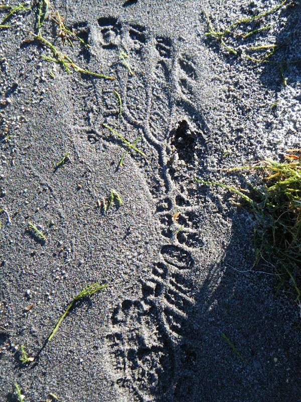
A familiar footprint
Blitzing the trails at Craters of the Moon
To cap off a sensational week, Craters of the Moon mountain bike park on the outskirts of Taupo was the last item on our list. Named after the volcanic craters that steam away in the park, a quality network of trails were just waiting to be explored. The fast flowing Outback trail gave us a good warm-up tour before we sweated up the Grinder, earning ourselves a fun and long winding descent which was aptly named Better than P.
By the time we arrived back in Auckland, after eleven days of glorious adventure by kayak, foot, and mountain-bike, we were exhausted. But not for long. Checking in on the teams from the 5-day GODZone Adventure Race in Queenstown, we almost forgot that these teams had been on the go for up to 120 hours with less than 3 hours sleep per night. I enjoy my sleep, but there is something extremely elusive about racing non-stop through the mountains of the south in a teams of four only kept together by an overwhelming sense of adventure, fun and insanity. What could be better?
It doesn't get much tougher than the Kawekas. Rated as the hardest mountain marathon in the North Island, the Kaweka Challenge Course #1 gained legendary status over the years that the Hawkes Bay Tramping Club ran the event every year in late February. Sadly, the smashfest had its last outing in 2011 when it was deemed too dangerous, too hard, and too difficult to organise.
The first ascent of Kuripapango
So. This Easter, Kristian Day, Ben Duggan, and myself, set out to end the drought, end the famine left in the wake of this awesome event's absence in twenty-twelve. Kristian scoffed at the DoC signs recommendation for "sturdy tramping boots" as he slipped on his Five-fingered Spyridons. I traced my finger over our route on the park map. We were excited and rearing to go.
6:52am at the trailhead beneath the imposing Kuripapango, basking in red sunrise, we began the long gallop. Into the Montagnes...
Five fingers clenching the trail
Above the clouds
The first of a long string of nutritional disasters began to emerge as we sweated our way to the summit of "The Hill" - Kuripapango. The first of many. 750m of climb burned into our cold calf muscles, a rude awakening. I was still half asleep after the pre-five-a.m. wakeup.
Trail-gasmic single-track spat us out of the plush pine forest and plunged us into the unknown. The morning was still unsettled, and mist blew us into a whiteout as we dodged tall rocky statues, struggling to negotiate steep switchbacks smothered in cinder scree. We arrived at Kiwi Saddle Hut still laughing and whooping.
Into the unknown
Back in the shelter of ridge-line bush, allowing us glimpses of "The Tits" (a unique rock formation on the next range) the layers of geothermal and ultra-core were stripped off. Just in time, the mist had cleared and we were now running across barren exposed tops. Classical Kawekas. Sun sprayed our backs with warmth, our only respite was that the April blaze had no chance of dealing out any sunburn, not today. A contrast to this time last April, Kaweka J was covered in snow by now! Weather at 1700 metres plays by its own rules. Especially on Kaweka J.
The lone runner
Kristian usually never considers lunching on the summit, gale winds often forcing him straight up and over - dashing for shelter. But today we chowed down on heavy-duty pizza, freshly baked by the legendary Ruby Muir. It does your soul a lot of good to escape the city push, to leave the rush behind you and get out in to the bush. And amongst the mountains, calories are the only currency.
Ruapehu and Ngauruhoe seemed so close ... only 100km of Kaweka and Kaimanawa lay between us.
Home to the infamous Kaweka-Kaimanawa Traverse. That's another story, for another day.
The sun beat down on us as we tackled the tops
Off the tops and onto the clay pans, we were gifted a temporary refuge from climbing. Even so, I was suffering. My quads were obliterated after the four-thousand-foot freefall from Kaweka J and I was now paying for it. Also, hunger was starting to dominate my thoughts, all I could think of was the loaded slice of pizza left in the car... Minimalism is a balancing act. Minimalism can be the difference between the worst time in your life and just a pleasant bizarre nightmare. Too much gear? Too much food? A slow, heavy time. Not enough gear? Not enough food? A cold, hungry time. What is better?
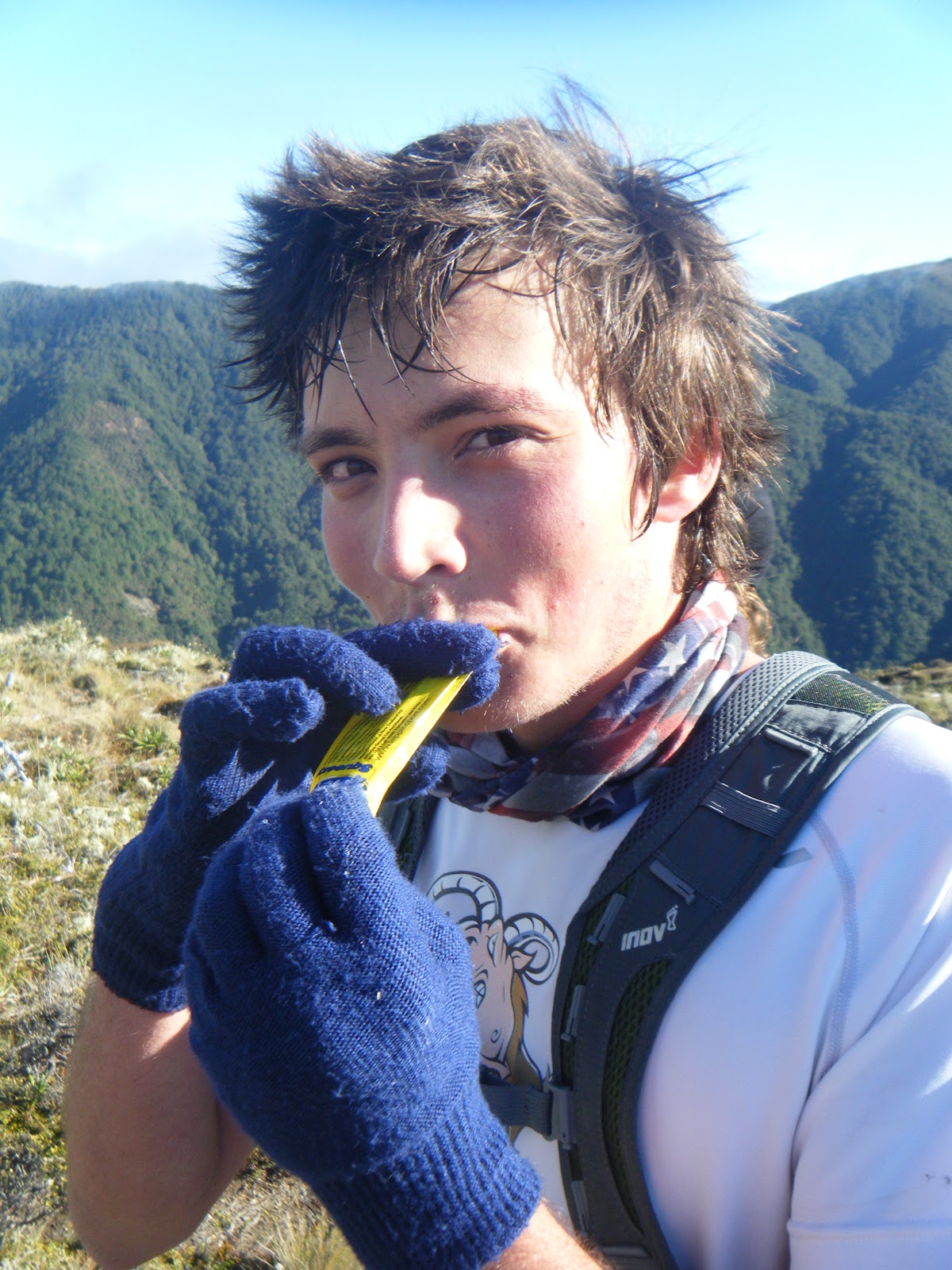
Ben sucking down a juicy Leppin energy gel
Ben and Kristian slogged on ahead, also suffering, starving, only a handful of leppin gels left to get them through the final 20km. We were now scrimping, saving and rationing.
Having a ball on the descent from Kaweka J
Soon we reached a decisive turn in our journey. We could clearly see our next trail marker, pinned to a pinus contorta only 1km away... on the other side of the ravine. All that lay in our way was the vast Donald canyon, a deep cavern measureless to man. The descent was steep going, the river was fast flowing, and on the climb our weariness showing.
Alive again - a wash in the Donald
But there was light at the end of the suffering. As we slogged up Kuripapango for the second time of the day, I remembered the bottle of Tui that I'd stashed in the bushes earlier that morning. Warm and fizzy - liquid gold. Energy that Leppin gels couldn't offer, we sprang down the 750m descent from K-Pong with only 3.5 short kilometres left to the car park... 9 hours 53 minutes, a long day.
It had been a dream of mine for over a year to visit the Kaweka Ranges. Its only when an event is cancelled that you realise that some opportunities can't be put off forever, or they'll disappear. Luckily, the mountains were still there, the same barren tops, the same deep river canyons, and the same brutal climbs. Bar a few hunters, we had the mountains for ourselves to enjoy on a rare day of perfect autumn weather.
Back at the car, we tucked into the long-awaited pizza, and all the hunger suffering was instantly forgotten. The only memories left were ones of awe and amazement, the Kawekas really lived up to their reputation! Like nowhere else in the North Island, I'll be back.
If the race is put back on in the future I'll be only too happy to enter... Summed up by Kristian Day from Eskdale, "It was a physical day, but, a good day, in the montagnes..."
See here the Garmin link to our route map, run statistics, and more...
The Kaweka Ballad
There's a trail, they said, o'er the range
But the way of it, none seemed to know
Yet the urge to try was upon me now
So I knew, I had to go
I leapt the dry stone wall
To the mountains I gave a call
We drank in the milk of paradise
Thats Leppin for those unaware
A speck, a mist, a shape I whist
This mountain range has days to twist
Cardomon and cinnamon
The taste of leppin from deep within
The mountains did decree
A cold and bitter symphony
Dealt out in torment thrice
Our only respite
A pot o' cream'd rice
Then shades stroll in of Kris and Ben
From out the swiriling fogs
Tales of tracks and other shacks
Of rivers, peaks and bogs
For I have watched the chamois leap
And seen the red stag run
And I have made the rifle crack
In the golden morning sun
Those far off ranges draw my mind
Of gorges, lawyer vine entwined
That unseen cord, umbilical
Attached to far off bush and hill
[Collaborated by Alastair McDowell]
Ben was so hungry at one point he tried to eat a deer
The Mohaka River is no river to be messed with, especially after three days of rain. Arriving at the brown, flooded river on Easter Friday was an eye opener. The muddy torrent owes it's source to high in the Kaweka Ranges, the full length winding its way through 140km of stunning and often very remote mountain country. Hawkes Bay's finest. And the only way to get there? On the water...
Don't Mess with the Mohaka
Over three days of the Easter weekend, I joined AUCC for a deluxe sequence of rafting and kayaking of the grade II and grade III sections of the mid-Mohaka. Our campsite was established at Willow Flat in the slushy riverside paddock. Over the following days we would learn to be satisfied living in the wet. That's what kayaking is about right? Three days of rain suited us fine, and could not stop us from setting alight a flaming bonfire every evening without fail.
Sam Manson in the thick of it
As the precautious club we were, we treated the first grade II section as an unknown river, confused by the turbulence and potentially blockaged by fallen trees in the past storm. So for the debut run, we took to the rafts to scope out the first 8km of white-water goodness.
No problems on the raft, we cruised down easily taking in the vistas for the first time, and enjoying being back on the water. The more experienced paddlers amongst us kayaked alongside also finding the river easy going despite the high flow.
Having graduated from the grade II, a night of fire food and folly rested us for the 'big day': it was time to tackle the grade III. Tight gorges, steep cliff faces, intense and extended rapids, small drop offs and more difficult route choice made this more challenging and more exciting than the grade II.. But again, this was an unknown river, still raging in flood - the nerves and apprehension showed on our instructors faces as they warned us of the dangers and tried to convince the weaker of us to drop out for another day...
Rip-roaring torrents did their best to flip us into the cold river.
The strong arm of hypothermia often punched through the river surface, licking our faces and trying to drag others down with her. One unlucky raft ahead of us plunged into a hole at an angle and were all ejected into the rapids - even with multiple thermals, a wetsuit and dry top, this meant a cold swim to shore. Out of the river to the stony bank, they needed to keep moving lest they make themselves a liability.
Precipitous eroded hillsides characterised the upper Mohaka section, and matched the greyish floodwater
A gourmet selection cooked over the Primus
Jenny showcasing her skills in the Grade III section, she was a fantastic instructor
Sigh of relief and a swig of satisfaction
A victory beer after surviving the Mohaka grade II sealed the deal. A huge buzz, and a fantastic Easter weekend.
Finally, read about a group of three adventure racers who decided to go 'Source to Sea' - kayaking the entire 140km of the Mohaka River. From the source located upstream of Tui's famous Mangatainoka Springs, winding through sections of up to grade IV rapids and waterfalls, the trio emerged at Mohaka township on the east coast in the winter of 2009.
For my third weekend based in Nelson I was keen to get out a bit further afield, beyond the bordering Richmond Ranges. Also, this weekend was rearing all over the country with mountain events - from the south, the glamorous Kepler Challenge 60km run in Te Anau. To the north, the infamous GOAT 21km around Ruapehu guaranteed to chew up your shoes, if not your soul. I had been looking forward to the Goat all year, but the Cook Strait proved too much of a logistical challenge. Plus, I was in the South Island already...
No Goat this year
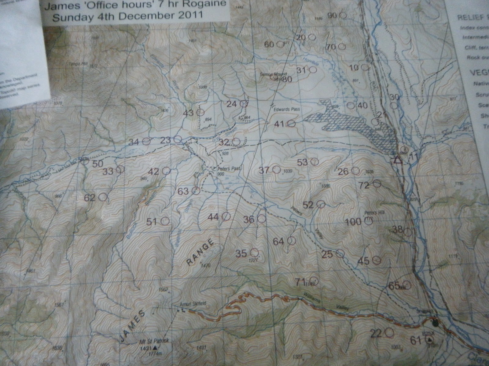
I found my revenge in the form of the St James "Office Hours" 7-hour Rogaine held in the ranges beyond Hanmer Springs. Although I couldn't find a team mate in Nelson, I didn't give up. I took a gamble, and made the 300km journey to registration at St James Homestead hopeful, and nervous, to find a team... Success! The gamble paid off, I joined up with Elisha Nuttall and Joel Smith from Canterbury and Otago, and we made the ultimate team.
Elisha & Joel rearing to go at briefing
THE MAP
High above the steamy Hanmer Springs, we were now in real Canterbury high-country, and the most incredible terrain for a rogaine I'd ever seen. Take a patch of North Island farmland, add some towering 1800m mountain ranges and braided river valleys, and you get the idea. A nor-westerly was threatening us with rain so we packed for the conditions, carrying a stash of Gore-tex and merino. Joel scoffed at the briefing and repped a cotton tee-shirt, the whole day.
First up the first hill, foolish but necessary
9:30AM: The horn sounded. We darted up the nearest knoll-top for our first 10 points of the day. We were in the lead. Our strategy was to start out with some flat controls to start the day at a good pace, we headed north and pick up up 7 more controls without much trouble. The second most-valuable control in the far north had a pot of jelly-beans at the flag, we were delighted. To be my downfall or not, this lead to me ditching my salami sandwiches, chasing a sweet-toothed sugar craving all day. Only one hour had passed, how long would I last?
Jelly Beans. Yummy
Rugged high-country terrain
We had a horrible time finding #60 perched on a saddle above Horrible stream - I was convinced we were at the right saddle and high point combination, but there was good reason why the compass didn't agree... Determined to make up time, we raced on to catch up the school team who had ashamedly crept past us.
Cresting the rocky spur to #70
After following the easy ridge up to Samoa Mound, we crashed down a scree slope into the valley heading west. We cruised through 5 easy controls, before filling up water in the DW stream. The terrain was extremely rough and made running hard at the best of times. We pushed straight up the hillside to collect #62, and while sidling round to the next stream gulley we met eventual winners Chris Forne and Nathan Fa'ave climbing in the opposite direction - clearing finding it hard work too!
Marshy, wide valleys to the west
Big scree covered slopes
With time ticking rapidly towards 7 hours, we had to start lowering our expectations, and we dropped four controls high on the St James range. We were saving our climbing energy for the big 100 pointer atop Peter's Hill - number-one priority in our race plan. We cleared the swampy Peters Valley of the low controls and made a late dash for the summit! 1 hour 20 to go...
Battling the weather to summit Peter's Hill
The rain that had held off all day finally made its presence known, and at 1100m above the valley plains we felt its full force. Joel, still hugging his cotton t-shirt and not much else, didn't complain, all eyes were focussed on avoiding the prickly matagouri scrub and searching through the mist for the orange-white control flag. Boom - there it is: we punched our wrist bands and scrambled into the final stream gorge to find #72. The clue seemed straightforward: "Base of rocky outcrop/spur".
Only a few obstacles before us to conquer
We spent 20 minutes of precious time searching the steep stream banks to find no said rocky outcrop - the 7-hour countdown was racing, find it or flee! One last desperate attempt for a valuable 70 points, we charged down the gorge to try and find it en-route to the finish checkpoint. There it was! For once it was the map who was wrong! By now we didn't care, and battled through the shrub up & over the spur to descend to the road - five minutes to go - three of us ran the final kilometre towards the finish, with a generous helping of seconds left in reserve.
FINISH.
6:58:34
We almost cramped stiff after stopping in the rain. Back to St James homestead for a few moist sausages cake and tea - no better way to finish an awesome day in the hills. Even better was the luck of finding such mint team-mates - Joel & Elisha were solid all day - even though we're spread across the country we'll definitely meet up for some adventures in the future...
Nathan Fa'ave and Chris Forne powered their way through the course to pick up 1620pts from a pot of 1710. Impressive stuff from the adventure racing & orienteering champs. We were happy with our collection of 1200pts, and picked up an iced Christmas cake for our efforts. Thanks to Grant Hunter and the team at NZ Rogaine Association for organising such a sweet event.
We woke from a luxurious twelve hour sleep in our campsite by Otaki Forks, already deep in the foothills of the tempestuous Tararua Ranges. When I stumbled out of the tent, I was disappointed. The brilliant sunset had been replaced with a billowing, brewing layer of cloud. Then I remembered the ranges' reputation: the fog mountains, they were. All the more epic for a mountain run!
Camping at the trail start paid dividends, we hit the trail direct from our tenting field. Over the swingbridge and we instantly felt initiated into the ranges. There's not much gentle about the place - a stiff climb greeted us from the offset and didn't relent for several hundred metres of gravel-crusted ascent. Within minutes we were raised from the river-side plateau and were gazing through the gorged valleys of Otaki Forks.
It felt good. Today we were cutting into fresh, mountain blood. There's nothing quite like venturing into a new mountain range; each step falling on virgin trail - we were excited. We soon climbed higher than volunteers could be bothered laying gravel - great-walk no more - a decisive transition into native Tararua forest and the run was now properly rugged. Beech leaves garnished the moist Greywacke, tangled in roots from warped Kamahi and Montane Podocarp. But whatever it happened to be, we puffed and ploughed over it, every drop of energy aimed at sending us higher and closer to the summit. Yes, the deadly Summit Fever was beginning to take hold.
Eventually we crested TiroTiro Knob and emerged out of the bushline to meet Field Hut. No ordinary hut, this was the first hut ever to be built in New Zealand, and is today one of nine hundred and sixty roofed siblings. It was built in 1924 by Tararua Tramping Club for the popular Southern Crossing trip traversing the ranges - the Wellingtonians obviously got sick of bivvying under canvas tarps every night. In a place this rugged I almost don't blame them.
I took a quick geeze through the hut-book to find some familiar faces - Anton Gulley & Peter Luk's small group of hardy AUTC mountaineers had come by this way in the deep snow of August.
We took a quick break to scoff down some Al's Powerbars, thermal up in the chilling weather, then back to the game. The remaining subalpine Beech quickly wore thin and we were running through alpine tussock grasslands. Steering into thick fog with less than fifty metres of visibility, every change in the trail came as a sudden surprise - mostly in the form of a hill. Tough the climb was sporadic not a consistent uphill grind, giving us plenty of chances to stretch our legs over some quick going mountain marshes and the occasional knoll descent.
Now approaching Kime Hut and up to twelve... thirteen... fourteen hundred metres high the wind became ferocious and the rain followed suit, hammering into our thin jackets sideways. We were pretty glad for the shelter at Kime Hut: if I'd been going solo I'd probably have turned back at this point. It was gnarly. If some emergency struck, with only a thermal and jacket I was under-prepared for the harshness of this mountain. So close to Hector that we could taste it, we buffed up and primed ourselves for the last push. We topped and dropped Field Peak blocking us from the summit, then fronted up to the beast himself...
Our blood was pumping with anticipation of summit-dom. Matt led the assault to the memorial cross at the summit, I followed close behind, and swallowed hard when I heard his victory cry of WHAKA YEAAHH!!
HECTOR.
Mount Hector...
Toby was stoked to reach the summit of Mt Hector
The weather was still atrocious at the peak, but our brains now well-marinated in toxic adrenaline - we revelled in it. Summit Fever had finally taken control. The two-metre high memorial cross was larger than I'd imagined - the plaque at its base commerates mountain-men who had died in the Great War. We breathed our last breath of summit, and set off the way we'd came, hoping to not suffer the same fate of those men. Hypothermia on this mountain was a real threat.
Hurrying back to the refuge of the bush
On the descent we passed a large group of school kids, Toby and Matt sprinted past giving them a shock but I stopped to find out they were from nearby Horowhenua College - I warned them to watch their step on this gnarly mountain, but I guess kids around here are bred tougher than in the north.
Opening up the hinds
From there the job was all but done. Once back inside the sanctuary of the bushline we could relax and take shelter within the plush forest again. We sped through the long downhill, enjoying the openness of the bush, and though muddy it was very runnable - a refreshing change from dirty Ol' Waitakeres. Every stride dowhill was a stride towards the warmer valley so we finally dried off and recovered after the pounding at Hector. At last at Otaki Forks we took a more adventurous route to the campsite along the Waiotauru River - with the rain it pushed a strong current that could be lethal with bad footing and a fall. Luckily we survived.
Dry underwear? Not anymore.
Exhausted, we reflected back at camp on the incredible adventure. Gazing back towards the hills still hidden inn cloud, it was hard to imagine how rough it had been only an hour ago, over a thousand metres above. The Tararuas had proven themselves a foe worthy, and to be taken seriously. In hindsight we were lucky to have claimed the summit and escape unscathed.
Our next mission will be to repeat Graeme Dingle's impressive traverse of the Tararua Range from North to South in twenty-four hours. Scanning along the topo map... for quite some time... we have our work cut out!
With the contagious Summit Fever finally wearing off, we continued our journey south...
Definition: Sum~mit Fe~ver [suhm-it fee-ver] noun
Dillusional mental state experienced at high altitudes, usually experienced while climbing to a geographic high-point.
Symptoms may include:
-Compulsive desire to run or climb up steep hills
-Heightened sweating rate and deep breathing
-Loss of judgement, inability to turn back to base of mountain despite external warning signs
-Rise in frequency of cold head rushes, excitement, elevated heart-rate, extreme alertness
-Increased awareness of how awesome the universe is.