Based in Pukawa Paradise in a cosy bach just out of Turangi, we found ourselves spoilt for choice. The bucket filled with the wonders of Tongariro was overflowing, and over three days we attempted to soak up as much of the adventure as we could. A well deserved day of rest was indulged in after an intense day in the Kaweka Ranges. So we feasted on many brews and weighed up our many options.
Clicking into gear at the crest of the 'Devil's Staircase'
The Tongariro Crossing may be a cliché for some people, or a long-term goal for others.Over used, over-used or not - on a pristine autumn morning, you don't get much better than this in Tongariro National Park. Setting off at 7:30am we were able to pass most of the traffic by the South Crater. This was my fourth time on the crater, and have never seen it so clear and calm. The atmosphere was incredible, we were in awe of the bellowing mountains.
Royal red - and not an ounce of snow - still a true summer crossing in the middle of autumn
Vibram FiveFingers - Ben's Bikilas ticking over on the smooth South Crater
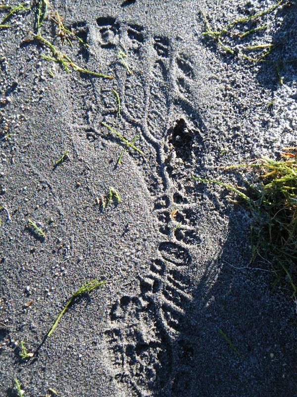
Ben and Kristian both decided to take on the Crossing running in their Vibram FiveFingers. Despite the trail's outward appearance of being rough mountainous terrain, since the trail is so well used the actual surface is about 75% finely crushed volcanic rock - an ideal running surface - the Vibrams had no problems skipping over the occasional rocky section. With a zero-drop heel and virtually no cushioning, each footstep would be placed exactly where it was intended.
An inspired mountain dance at the Emerald Lakes
The final climb to Blue Lake before the buzz downhill!
We were in two mindsets on the run - half of us wanted to push ourselves and see how fast we could churn through the 19.8km trail. The other half wanted to savour the rare occasion of a completely clear morning in the midst of the mountain arena. In the end we managed both, taking photos on the run and stopping for the occasional intoxicating sulphur whiff at the lakes.
Blue Lake
A sensational view over Turangi and the gleaming Lake Taupo. Kristian cranking a casual mid-descent air guitar riff
Once past the North Crater we took on the 1100m descent with full force not stopping till we reached the Ketetahi Carpark. From Mangatepopo to Ketetahi in 2hrs15 sounded good to the ear, but upon learning that the record was 1hr25 set by Callum Harlind, we felt put in our places!
Lake Rotopounamu - pristine
Lake Rotopounamu is found secretly perched behind Turangi, a local taonga to the Maori. We shared their treasure on another crisp Tongariro morning, encircling the 7km lake-loop slowly, still recovering from the past week's activity. The huge amount of net downhill had punished our quads like never before. Even so it was worth the brief pain warming up to discover another beautiful new place.
Clear reflections
A familiar footprint
Blitzing the trails at Craters of the Moon
To cap off a sensational week, Craters of the Moon mountain bike park on the outskirts of Taupo was the last item on our list. Named after the volcanic craters that steam away in the park, a quality network of trails were just waiting to be explored. The fast flowing Outback trail gave us a good warm-up tour before we sweated up the Grinder, earning ourselves a fun and long winding descent which was aptly named Better than P.
By the time we arrived back in Auckland, after eleven days of glorious adventure by kayak, foot, and mountain-bike, we were exhausted. But not for long. Checking in on the teams from the 5-day GODZone Adventure Race in Queenstown, we almost forgot that these teams had been on the go for up to 120 hours with less than 3 hours sleep per night. I enjoy my sleep, but there is something extremely elusive about racing non-stop through the mountains of the south in a teams of four only kept together by an overwhelming sense of adventure, fun and insanity. What could be better?
It doesn't get much tougher than the Kawekas. Rated as the hardest mountain marathon in the North Island, the Kaweka Challenge Course #1 gained legendary status over the years that the Hawkes Bay Tramping Club ran the event every year in late February. Sadly, the smashfest had its last outing in 2011 when it was deemed too dangerous, too hard, and too difficult to organise.
The first ascent of Kuripapango
So. This Easter, Kristian Day, Ben Duggan, and myself, set out to end the drought, end the famine left in the wake of this awesome event's absence in twenty-twelve. Kristian scoffed at the DoC signs recommendation for "sturdy tramping boots" as he slipped on his Five-fingered Spyridons. I traced my finger over our route on the park map. We were excited and rearing to go.
6:52am at the trailhead beneath the imposing Kuripapango, basking in red sunrise, we began the long gallop. Into the Montagnes...
Five fingers clenching the trail
Above the clouds
The first of a long string of nutritional disasters began to emerge as we sweated our way to the summit of "The Hill" - Kuripapango. The first of many. 750m of climb burned into our cold calf muscles, a rude awakening. I was still half asleep after the pre-five-a.m. wakeup.
Trail-gasmic single-track spat us out of the plush pine forest and plunged us into the unknown. The morning was still unsettled, and mist blew us into a whiteout as we dodged tall rocky statues, struggling to negotiate steep switchbacks smothered in cinder scree. We arrived at Kiwi Saddle Hut still laughing and whooping.
Into the unknown
Back in the shelter of ridge-line bush, allowing us glimpses of "The Tits" (a unique rock formation on the next range) the layers of geothermal and ultra-core were stripped off. Just in time, the mist had cleared and we were now running across barren exposed tops. Classical Kawekas. Sun sprayed our backs with warmth, our only respite was that the April blaze had no chance of dealing out any sunburn, not today. A contrast to this time last April, Kaweka J was covered in snow by now! Weather at 1700 metres plays by its own rules. Especially on Kaweka J.
The lone runner
Kristian usually never considers lunching on the summit, gale winds often forcing him straight up and over - dashing for shelter. But today we chowed down on heavy-duty pizza, freshly baked by the legendary Ruby Muir. It does your soul a lot of good to escape the city push, to leave the rush behind you and get out in to the bush. And amongst the mountains, calories are the only currency.
Ruapehu and Ngauruhoe seemed so close ... only 100km of Kaweka and Kaimanawa lay between us.
Home to the infamous Kaweka-Kaimanawa Traverse. That's another story, for another day.
The sun beat down on us as we tackled the tops
Off the tops and onto the clay pans, we were gifted a temporary refuge from climbing. Even so, I was suffering. My quads were obliterated after the four-thousand-foot freefall from Kaweka J and I was now paying for it. Also, hunger was starting to dominate my thoughts, all I could think of was the loaded slice of pizza left in the car... Minimalism is a balancing act. Minimalism can be the difference between the worst time in your life and just a pleasant bizarre nightmare. Too much gear? Too much food? A slow, heavy time. Not enough gear? Not enough food? A cold, hungry time. What is better?
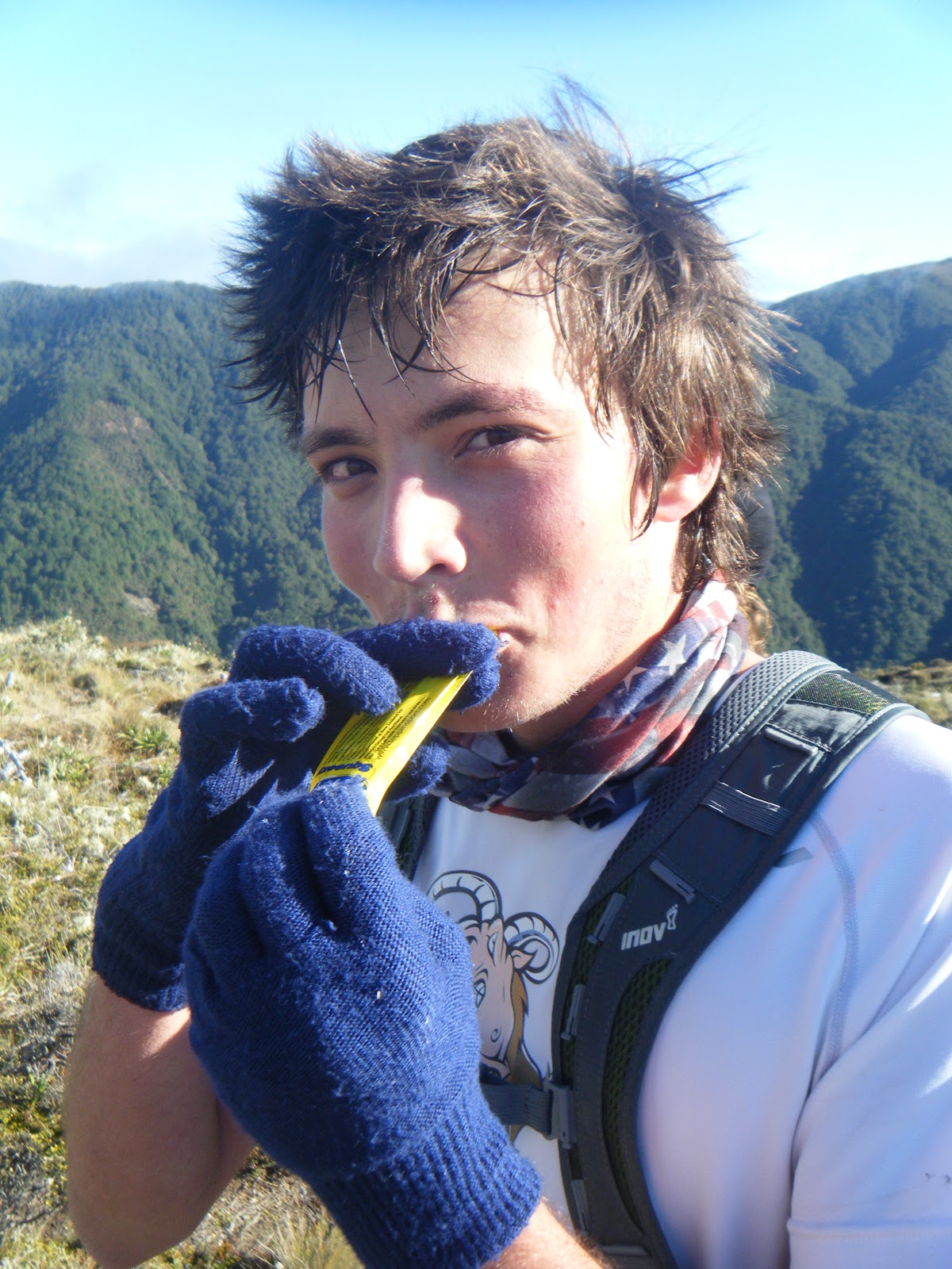
Ben sucking down a juicy Leppin energy gel
Ben and Kristian slogged on ahead, also suffering, starving, only a handful of leppin gels left to get them through the final 20km. We were now scrimping, saving and rationing.
Having a ball on the descent from Kaweka J
Soon we reached a decisive turn in our journey. We could clearly see our next trail marker, pinned to a pinus contorta only 1km away... on the other side of the ravine. All that lay in our way was the vast Donald canyon, a deep cavern measureless to man. The descent was steep going, the river was fast flowing, and on the climb our weariness showing.
Alive again - a wash in the Donald
But there was light at the end of the suffering. As we slogged up Kuripapango for the second time of the day, I remembered the bottle of Tui that I'd stashed in the bushes earlier that morning. Warm and fizzy - liquid gold. Energy that Leppin gels couldn't offer, we sprang down the 750m descent from K-Pong with only 3.5 short kilometres left to the car park... 9 hours 53 minutes, a long day.
It had been a dream of mine for over a year to visit the Kaweka Ranges. Its only when an event is cancelled that you realise that some opportunities can't be put off forever, or they'll disappear. Luckily, the mountains were still there, the same barren tops, the same deep river canyons, and the same brutal climbs. Bar a few hunters, we had the mountains for ourselves to enjoy on a rare day of perfect autumn weather.
Back at the car, we tucked into the long-awaited pizza, and all the hunger suffering was instantly forgotten. The only memories left were ones of awe and amazement, the Kawekas really lived up to their reputation! Like nowhere else in the North Island, I'll be back.
If the race is put back on in the future I'll be only too happy to enter... Summed up by Kristian Day from Eskdale, "It was a physical day, but, a good day, in the montagnes..."
See here the Garmin link to our route map, run statistics, and more...
The Kaweka Ballad
There's a trail, they said, o'er the range
But the way of it, none seemed to know
Yet the urge to try was upon me now
So I knew, I had to go
I leapt the dry stone wall
To the mountains I gave a call
We drank in the milk of paradise
Thats Leppin for those unaware
A speck, a mist, a shape I whist
This mountain range has days to twist
Cardomon and cinnamon
The taste of leppin from deep within
The mountains did decree
A cold and bitter symphony
Dealt out in torment thrice
Our only respite
A pot o' cream'd rice
Then shades stroll in of Kris and Ben
From out the swiriling fogs
Tales of tracks and other shacks
Of rivers, peaks and bogs
For I have watched the chamois leap
And seen the red stag run
And I have made the rifle crack
In the golden morning sun
Those far off ranges draw my mind
Of gorges, lawyer vine entwined
That unseen cord, umbilical
Attached to far off bush and hill
[Collaborated by Alastair McDowell]
Ben was so hungry at one point he tried to eat a deer
The classical Nelson Lakes view: Lake Rotoiti from St Arnaud
Nelson - the top of the south. So its fair enough that it hosts the magnificent Nelson Lakes National Park - the northern-most strain of the Southern Alps.
Despite their grandeur, I couldn't find anyone to accompany me on the ambitious journey I'd set through the park this weekend. So I took to the mountains solo. No need to worry, I was well equiped, into my new 25 litre pack I stashed a sleeping bag, goretex jacket, a few thermals and plenty of food. A short ninety minute drive from Nelson to Robert Ridge, I left straight after work and was on the trail by 6pm - onwards to Speargrass Hut!
Crossing the Speargrass Creek bridge to the hut
Stage 1: Robert Carpark -> Speargrass Hut (1hr15)
No time to lose, I was off. Still getting used to running with a 6-8kg pack on my back, I had a leisurely jog to the hut, sidling around the head of Mt Robert and alongside Speargrass Creek. The hut was perched in an open clearing of, surprisingly, speargrass - late evening cloud hung around the epic looking gulley towards Lake Angelus... I decided to call it a night here, and rest up for the big trek tomorrow.
Israeli Man saying goodbye at Speargrass Hut
I shared a breakfast of PowerBar muesli in a bag with an Israeli couple, and a British tramping family who were forever asking their son Thomas to kindly brush his teeth. Too bad I'd ditched mine - unnecessary weight! The water was so pure, my teeth were cleaned to mountain-stream fresh breath standard.
Stage 2: Speargrass Hut -> Sabine Hut (1hr40)
On the road at a spritely eight o'clock, I took to the gradually declining trail to Sabine Hut with gusto. I passed a few small forest tarns along the way, uniquely out of place. In the huge scheme of time, I cut through the still forest as a momentary blur.
Blue blur through the greenery
Was this a great mass of blue sky appearing through the trees, or the huge still expanse of Lake Rotoroa? The air was still but for the irritating buzz of sandflies - I avoided being their morning tea and spent mine swimming in the lake. Cool and refreshing, I drank as I swam. The lake's surface coated in spongy moss gave my feet a good massage before moving on down the Sabine River.
Early morning bath at Rotoroa
Stage 3: Sabine Hut -> West Sabine Hut (2hr30)
Travelling down the true right bank of the river made for an idyllic run. It felt like true South Island, open grassy patches with views down the river to the high 2000m peaks still holding snow at the tops. The track was mostly flat, except for a few "step-ups" as an Australian tramper put it, the trail was fast going helping me to cut the tramping time to West Sabine hut in half.
Cairns lead the way
Taking a break by the river
To cross the river though, not quite so easy! - the bridge had been smashed in a flood, and the warped wreckage was still hanging in the blue rush. Thanks to some local knowledge, I found a log conveniently lying across the river, which I waltzed across. As it turned out, this one broken bridge would affect almost everyone on the circuit and everyone planning to come in the next week - with big downpours forecast, the tame Sabine would soon become a raging, rising torrent.
Tricky traverse
Stage 4: West Sabine -> Upper Travers (2hr50)
After a cramp relieving lunch with a fellow solo Swiss man, I braved the brutal climb ahead up to Travers Saddle. Still sucking down gallons of the sweet stream nectar, I realised I was over-hydrating when I started stumbling in a dizzy haze all over the trail. Too much of a good thing - I decided my blood electrolytes must have been diluted from all the drinking, so I rushed a sachet of Vitasport into my reservoir, along with a gel-shot of Leppin. I slapped my face together, and it made all the difference. December two years ago I was cruising down this steep scree slope with Rangitoto College tramping friends. What a challenge attacking the slope from this direction! Every so often I paused to catch my breath, but looking back to see where I'd come, my breath was instantly taken away....
Magical run
I reached the saddle at 4pm, exhausted but revelling. Mt Travers looked dangerous, a lot sharper than I'd remembered... Being alone high on a mountain pass made most things seem more extreme, although I was still in just a t-shirt and shorts, there was barely a zephyr of wind pushing through the saddle - bizarre. The weather always a huge controlling factor had made today's epic journey a lot tamer than it could have been.
The Triumph of Travers Saddle
I hopped down the boulder field a few hundred metres to Upper Travers hut, staunch at the head of the Travers Valley. There I met a real crowd, a swift contrast to my high wilderness experience minutes before. Older folk from Melbourne, two brothers from Arizona USA, as well as the usual European cocktail. They were all interested to hear about my quest - they had not yet been over the saddle, so I shared my tales about the wonders of the valley yonder.
Stage 5: Upper Travers -> John Tait (1hr)
Although I relished the company and donations of tea and chocolate, I was itching to get a bit further before dark to make Sunday a short one. My feet became itchy after two hours in the hut... and before I knew it I was waving to my new friends from down the valley before disappearing into the bush again. But to my horror, when I finally made it to John Tait just before dusk, the hut was empty! This second contrast of the day, a very long day, made for a very lonely night. I set the fireplace ablaze to keep me company, the licking flames and crackling beech leaves my only amigos in the huge hut. I collapsed into my new Mountain Hardware Phantom 45 sleeping bag, enjoying all 500 grams of down powered warmth.
Warmth
Stage 6: John Tait -> Hopeless (1hr40)
As it turned out, the head-start I gave myself outweighed itself as a sleep-in. Well worth it. The green-moss goblin-like forest woke me up as I followed the Travers river downstream to the infamous Hopeless Valley. Ironically, it really did live up to its name this time two years ago - heavy rains flooded the creeks and we were trapped an extra day - we escaped barely before Search & Rescue were called! So I started up the creek with trepidation, along with a huge dose of nostalgia and flashes of déja-vu.
Harry Hancock & co - Hopeless Hut founder
The creek was so low, a mockery to our epic survival battle back in 2009. Hopeless Hut had even had a makeover, the cracked windows and rusted sink replaced and shining new. This hut, one of my favourites in NZ, has rich history - and by some great fortune, when I arrived I met the Harry Hancock - the man who built the hut back in the 1950's! It was opened by none other than Sir Edmund Hillary. Its vintage gives the shack real character, I find the new modern huts lack soul. But in the wilderness a roof is a roof! If its rainin' you ain't complainin'.
Stage 7: Hopeless -> Angelus (2hr50)
I gritted my teeth for my last hurdle - I reminded myself that from Sunset Saddle its all downhill to the finish. This was my mantra as I picked my way through the vaguely marked cairns up the the rugged scree basin. Not basin, ocean. An ocean of rock determined to sink my ankles and slow my progress towards the saddle surface. Deciding that the markers had been designed for people coming down from Sunset, I was all but left stranded in terms of navigation and had to decipher my own route up around the daunting waterfall face and around the misty alpine tarns.
Mountain Arena
Alone in this wild mountain arena now felt the most remote of all. It was overwhelming, and almost hard to breathe at times as my guts clenched in a sensation overload. Mist crept over the ledge I'd just climbed, and with it a jagged whiplash of chill forced me to a thermal for the first time. Again the extended effort of climbing almost 1000 metres from the valley floor, combined with low sugar levels was making me feel delirious - I gave up holding out for lunch at the hut, and stopped just below Sunset Saddle for a much needed boost. And that I did, I cut steps up the last snowy slope to finally reach the saddle, marked with a huge mound of rocks. Phew. From Hopeless to [the wings of] Angelus.
Stage 8: Angelus -> Robert Carpark (1hr50)
Feeling absolutely shagged by the time I stumbled into the new hut at Lake Angelus, the warden took pity on me and boiled me up a heavenly cup of tea. I had two. Of the five approaches to Angelus, the route via Sunset Saddle is the hardest and most untracked of all - in fact it’s not even marked on the map! Definitely the most satisfying though.
Warden gazes over the lake to Sunset Saddle
Now all that lay before me was 12km of snaking ridgeline over the open rolling tops to Mt Robert. The trail was rough as it sidled the notable Julius Summit, I skipped over plate-like shards of rock crumbling from the Roman's terraces. At last Lake Rotoiti re-appeared, heralding the incredibly nauseasly steep, zig-zagging "Pinchgut" track. I collapsed in a heap at the car park, with no one else around except the beech trees towering around me, unfazed and unaware of the journey I'd just completed.
Descending the Pinchgut
It was hugely satisfying to conquer the whole Sabine-Travers circuit in just a weekend, and such a success that this may be the first of more multi-day runs to come. The "Solo Experience" was new and exciting, especially when tested out for the first time in the magnificent setting of Nelson Lakes. Though for every awesome moment of silence, there was always a tinge of loneliness. For safety's sake I'll keep solo trips at a minimum, as long as I can convince someone to join me - that means you!
C'EST FINI
Run statistics
Distance: 74.2km (7km, 40km, 27km)
Vertical gain: 4733m
Max slope: 55% (Sunset Saddle route)
Huts: 8 (Speargrass, Sabine, W. Sabine, U. Travers, John Tait, Hopeless, Angelus, Relax Shelter)
Labour Weekend came at just the right time. Rugby World Cup finals weekend, and also the end of a second semester of Engineering. Perfect chance to get out of the big smoke, and no better way to celebrate that than with a smorgasbord of trail running in the off-road mecca that is Rotovegas! I drove down with hilarious Australian side-kick Matt Meckenstock, but only after playing cat & mouse to find him on K road amongst a sea of Welsh & Australian fans - Matt was more worried about putting the Welsh in their place and making them wish they were in yellow!
The gang: Ruby, Matt, Bryan, Me, Malcolm, Kristian, Paul, Kerry, Jo, Sarah
Photo: RunningWildNZ
Saturday began with a 13km jaunt through the Whakarewarewa forest with Kristian Day, Ruby Muir, Matt Meckenstock, Timothy Burrell, and the efficiently late-arriving Kerry Suter. A stirling line-up to say the least. As we emerged from the Redwoods, Green Lake appeared in true Rotorua turquoise blue with the rich accompanying aromas that we all know and love. At the end of the plush lake-side trail we met with Paul Charteris' band of old-hands to the trail game.
Sublime running alongside Okataina
We were here to celebrate Paul's birthday, from here we would guide us on an exclusive tour of the new trail section for the future Tarawera Ultramarathon 100-miler. The Tarawera race is Paul's brainchild, and is rapidly becoming one of the must-do 100km runs in New Zealand. As if 100km wasn't enough, a new 100miler event will start at Tarawera outlet at dusk, and take the trail warriors over the mighty Mount Tarawera through the night to the Redwoods where they continue the centurion onwards to Kawerau! Sign me up, did you say?
Downhill carves its way down the gulley
The new trail was excellent. There's nothing much better than running virgin trail - untouched, untamed, and all the while unknown - what is around the next corner? Time to find out. We blissfully ignored the "DO NOT PROCEED - TRACK IN CONSTRUCTION"... signs, to later find that at one point the cliff-side was completely washed out. We realised why we'd brought the resourceful Kerry Suter - from his bulging pack he unravelled a length of rope, quite useful for an abseil...
Kerry makes the abseil look easy. Photo: RunningWildNZ
A little yonder we discovered a cool spring, gushing straight from the earth. Purest water in NZ in my opinion, bar Nelson. Nelson has the best water in NZ.
Relaxing at the springs. Photo: RunningWildNZ
After a goat-worthy uphill grunt and screaming downhill with Kerry chasing at my heels, Hot Water beach arrived in view. Here Kerry is checking the map. Something doesn't seem quite right. I, meanwhile, plunged in without hesitation...
"Hmmm the trail seems to have ended. Better check the map"
At the end of the 31km we indulged in some post-run whiskey and mallow-puffs at Hot Water Beach. To equalise our core temperatures we stood in the rain while scolding our feet in the squalls of boiling water floating in with the tide. Kristian was so knocked out from the festivities that he decided he wasn't up for the return journey, and instead we opted for the boat cruise home...
Proud to be a Kiwi on a weekend like no other
Paul breaks out his Poi Poi skills
We spent the afternoon at Paul's sipping on cool beverages, and eating junk food like every good trail runner should do. Mexican was the menu for the evening, and with that the beefiest-bean-burritos in town! When the sun gave the Northern hemisphere a chance to hit the trails, Paul and Kate Townsley exhibited their glowing Poi-Poi and Fire ball skills for a spectacular display.
Sunday dawned a new day, and we took advantage with another trail run based from Lake Rotoiti. We ventured along more virgin trail up a meaty uphill, shaking loose the bonds from the previous night, and sending us whooping down the most sensational down-hill sections of the weekend. The photo below is a close representation of the adrenaline-flowing, eye-watering action as we approached terminal cadence.
Blitzing through plush trail
Once we'd recovered from that buzz, we found ourselves in a clearing - a forest ampitheatre - where our calls of TAAA- RAAA- WERAAA echoed for miles around.
Gazing out over Lake Okataina
From Okataina we were treated to more glorious lake-side running towards Humphries Bay. At one stage our enthusiasm was too much for a young family out tramping, as we flew past on one tight corner. "Sorry!"
Kristian and Ruby pacing along to Humphries Bay
Running with All Blacks flag flapping proudly
Returning around the western side of Lake Okataina was a tough ordeal. The legs were now feeling the toll of two long runs back to back, and an insatiable was too much even for Al's Powerbars, the energy-packed bars fell helplessly into a pit of endless hunger. Matt Meckenstock was feeling it too. Kristian Day and Ruby Muir meanwhile were flying ahead on their Leppin & Plum lined stomachs. Millar Road did eventually materialise, and with it a bunch of grapes - swallowed whole.
Lake Okataina
After the almighty effort, we didn't waste time driving back to Auckland just in time to witness the All Blacks become World Champions against the threatening Français... From Trails - to Champions.