Featured articles

Sunday 18 December 2011

You win some, You lose some: In the Kahurangi


I lay on the ground in agony. My ankle throbbed, sending shoots of pain up my calf. Alone in the wild Kahurangi Jungle, I wondered why I put myself through such hardships. And still a few kilometres away from my car, time was ticking down to the Cook Strait ferry crossing, far away in Picton.

Rewind one week...


...I find myself climbing up the easy Chummies Track with three friends - my first trip to the Kahurangi. Although the hut waiting for us at the bushline was rarely visited, the bushy ridge track was smooth & clear, showing little sign of the floods and slips that had devastated nearby Nelson during the week. The relentless 72-hours of rain had finally let up for us this weekend, so when we finally emerged onto the ridge top, the clouds swirled around the surrounding summits for a sweet sunset.
Wild Tussocky Ridgeside
John Reid Hut was a small 6-bunker with an open fireplace – put to good use for our creamy pasta concoction. Another advantage to taking it slow – a hot meal at the end of the day! Sure beats cheese & crackers for dinner as I had done at Nelson Lakes.


The stately John Reid Hut
We were too lazy to get up early for the sunrise, but luckily my cousin Raymond Salisbury was onto it when he came here. This is what we slept through... a really incredible place caught at just the right moment.

Mt Patriarch - Raymond Salisbury
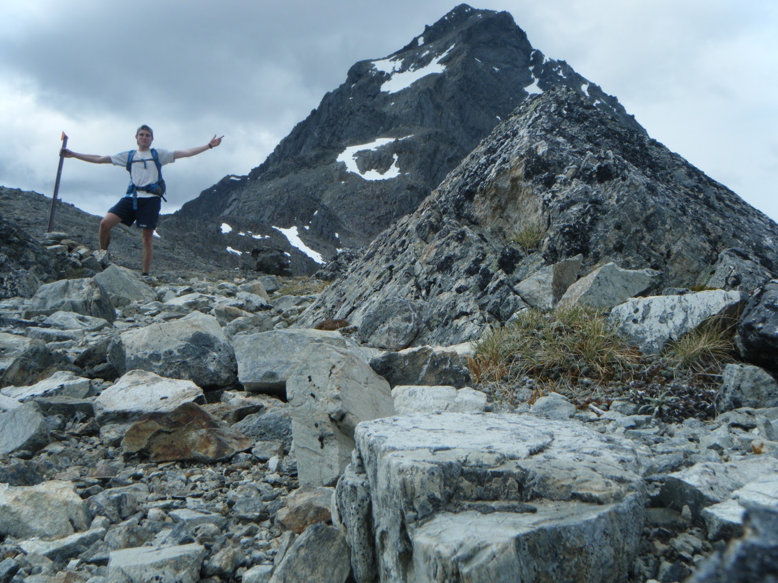
First thing on Sunday, we climbed through thick tussock and snowgrass, forging our own path to gain a better view of the territory. Each of us tried to find the easiest route up top, to balance on the knife edge of the imposing ridge leading towards Mt Patriarch.

Mt Baldy to the left, Gomorrah hiding under cloud in centre
Peering over the edge, all of the Kahurangi lay before us. Vast and remote, you could easily spend a year lost in these mountains, we thought. We were more than satisfied with just a weekend for now. The sharp granite face of Mt Baldy gleamed, stealing attention from Mt Sodom and Gomorrah close behind.

What a ridge
"This ridge is tops!"
We were having way too much fun trekking along the ridge and lying in the snowgrass lapping up the views, that time flew by overhead and took our chance at the summit in it's beak. Shortly after we spotted a Kea - shouldn't you be stealing boots in Arthurs Pass? We weren't too worried, today the view of the impressive peak was enough. 

What a day - heading down to the Gibbs Valley


Considering his options... 
We wandered along the valley floor beside the meandering Wangapeka, all very relaxed. We were back in Nelson for dinner, a perfectly good trip. There was nothing painful or hard about the trip, the views and the company was great. And all that stuff. But...

Wangapeka River
Fast forward a week...

This isn't just another story of a day spend discovering a new ridgeline.

This is about a search for my roots - back to the source. Following more than the line of a rocky knife edge, today I was following my line of ancestors - following the footsteps of triple Great Grandfather John Park Salisbury, the man who pioneered the first tracks and farming through these ranges. While some of us we were tramping in Goretex-lined boots and carrying 500-gram sleeping bags, JP would have been forging this same route with gear that belonged in the mid 1800s. And all without the help of topomaps and DoC markers.

While driving to work the following Friday morning, the crisp ridgeline and smattering of snow on the Twins and Mount Arthur was irresistible. Learning of the early 2pm finish for Christmas, it was a no-brainer! Amped, I flew along the coastal highway past Motueka to begin my spontaneous evening trip.


However, my troubles started early... I overestimated the off-road capabilities of my Nissan Pulsar and bottomed out on the muddy road to the track! I spun my New Balance wheels back to a family Christmas camp where I found help to haul me out of the ditch. Phew. 

IN MY HASTE to make up lost time, I found myself half an hour down the track with NO FOOD! Devastated, I plodded back to the car ready to drive home, ready to give up. But wracked with guilt as I could feel Old Man Salisbury watching from above, I couldn't leave yet. I grabbed my food bag with a sigh, and for the fourth time, I ran into the hills...

Dense Kahurangi forest, penetrating streams
A few hours before at the Christmas camp, I'd been told the track "wasn't too flash". "Five hours to the hut", they said. I'd smiled and told them "E kore e mau ia koe, he wai kai pakiaka - A foot accustomed to running on roots makes the speediest runner".

But now in the thick of it, pushing onto 8pm, crossing deep streams with deep climbs either side rutted with deep, thick roots... I was starting to feel like the slowliest runner. Desperately trying to cut down the tramping time as I wasn't keen to arrive at midnight, I threw myself at every climb burning my legs to oblivion and leaving a salty trail in my wake.

I felt lost travelling up the steep valley, slips and windfalls had disguised the trail, sending me into a bush-cracking frenzy. Through the thick canopy I tried to pick up features around me, but I was already falling into "WHERE IS THE HUT" mode, where anything could look like the hut. A patch of sky must mean the Ellis Basin! ...but time wore on, twilight darkened, and the climb steepened...

I had earlier dreamed of an epic midnight ascent of the mountain, I can always sleep later right? Wrong - I conked out within minutes inside the smoky hut, though my empty stomach soon stirred me to down a few mouthfuls of cheese and bread. Exhausted. Why? 

Late dusk arrival: Mount Arthur

Mt Arthur, Ellis Basin Hut at dawn. If only...
I sprung awake at 6.15am after a fitful sleep. Spurred on by fear of missing the ferry, I set an unofficial record for leaving a hut, from the horizontal to the vertical in 16 minutes. Somehow, the run down took exactly the same time as the ascent. Last night's mission and lack of sleep slowed my reflexes, so every rooty descent was technical and awkward. At my lowest point I managed to catch both feet under roots: I tumbled to a jolt, whacking my knees on rocks in the process...

I drove off, aching & hungry, looking back enviously at Mount Arthur, glowing mockingly in early sun. This means I'll have to come back now!

The Hard Way
Although this could have been a great two-day wilderness experience, I'd somehow turned it into a rushed, lonely, and painful twelve hours! Back to the drawing board? Once I had boarded the ferry and my fear of missing Christmas in Auckland had subsided, I could relax and rethink the trip. I'd learned a few lessons that's for sure. But did I regret the trip - should I have stayed home and packed? 


Ellis Basin Caves
.Wondering why I had chosen such an unused, obscure route to Mt Arthur I was surprised to later find out that the Ellis Basin marks the entrance to the deepest cave in the Southern Hemisphere! In January 2010 an extreme team of Kiwi cavers led an expedition into the giant cave network, to go where no-one had gone before. My trip seemed worthwhile after all. Next time I'll take a rope.

Sunday 11 December 2011

Nelson Lakes

The classical Nelson Lakes view: Lake Rotoiti from St Arnaud
Nelson - the top of the south. So its fair enough that it hosts the magnificent Nelson Lakes National Park - the northern-most strain of the Southern Alps.

Despite their grandeur, I couldn't find anyone to accompany me on the ambitious journey I'd set through the park this weekend. So I took to the mountains solo. No need to worry, I was well equiped, into my new 25 litre pack I stashed a sleeping bag, goretex jacket, a few thermals and plenty of food. A short ninety minute drive from Nelson to Robert Ridge, I left straight after work and was on the trail by 6pm - onwards to Speargrass Hut!
Crossing the Speargrass Creek bridge to the hut
Stage 1: Robert Carpark -> Speargrass Hut (1hr15)
No time to lose, I was off. Still getting used to running with a 6-8kg pack on my back, I had a leisurely jog to the hut, sidling around the head of Mt Robert and alongside Speargrass Creek. The hut was perched in an open clearing of, surprisingly, speargrass - late evening cloud hung around the epic looking gulley towards Lake Angelus... I decided to call it a night here, and rest up for the big trek tomorrow.

Israeli Man saying goodbye at Speargrass Hut
I shared a breakfast of PowerBar muesli in a bag with an Israeli couple, and a British tramping family who were forever asking their son Thomas to kindly brush his teeth. Too bad I'd ditched mine - unnecessary weight! The water was so pure, my teeth were cleaned to mountain-stream fresh breath standard.

Stage 2: Speargrass Hut -> Sabine Hut (1hr40)
On the road at a spritely eight o'clock, I took to the gradually declining trail to Sabine Hut with gusto. I passed a few small forest tarns along the way, uniquely out of place. In the huge scheme of time, I cut through the still forest as a momentary blur.

Blue blur through the greenery
Was this a great mass of blue sky appearing through the trees, or the huge still expanse of Lake Rotoroa? The air was still but for the irritating buzz of sandflies - I avoided being their morning tea and spent mine swimming in the lake. Cool and refreshing, I drank as I swam. The lake's surface coated in spongy moss gave my feet a good massage before moving on down the Sabine River.

Early morning bath at Rotoroa
Stage 3: Sabine Hut -> West Sabine Hut (2hr30)
Travelling down the true right bank of the river made for an idyllic run. It felt like true South Island, open grassy patches with views down the river to the high 2000m peaks still holding snow at the tops. The track was mostly flat, except for a few "step-ups" as an Australian tramper put it, the trail was fast going helping me to cut the tramping time to West Sabine hut in half.

Cairns lead the way
Taking a break by the river
To cross the river though, not quite so easy! - the bridge had been smashed in a flood, and the warped wreckage was still hanging in the blue rush. Thanks to some local knowledge, I found  a log conveniently lying across the river, which I waltzed across. As it turned out, this one broken bridge would affect almost everyone on the circuit and everyone planning to come in the next week - with big downpours forecast, the tame Sabine would soon become a raging, rising torrent.

Tricky traverse
Stage 4: West Sabine -> Upper Travers (2hr50)
After a cramp relieving lunch with a fellow solo Swiss man, I braved the brutal climb ahead up to Travers Saddle. Still sucking down gallons of the sweet stream nectar, I realised I was over-hydrating when I started stumbling in a dizzy haze all over the trail. Too much of a good thing - I decided my blood electrolytes must have been diluted from all the drinking, so I rushed a sachet of Vitasport into my reservoir, along with a gel-shot of Leppin. I slapped my face together, and it made all the difference. December two years ago I was cruising down this steep scree slope with Rangitoto College tramping friends. What a challenge attacking the slope from this direction! Every so often I paused to catch my breath, but looking back to see where I'd come, my breath was instantly taken away....

Magical run
 I reached the saddle at 4pm, exhausted but revelling. Mt Travers looked dangerous, a lot sharper than I'd remembered... Being alone high on a mountain pass made most things seem more extreme, although I was still in just a t-shirt and shorts, there was barely a zephyr of wind pushing through the saddle - bizarre. The weather always a huge controlling factor had made today's epic journey a lot tamer than it could have been.

The Triumph of Travers Saddle
I hopped down the boulder field a few hundred metres to Upper Travers hut, staunch at the head of the Travers Valley. There I met a real crowd, a swift contrast to my high wilderness experience minutes before. Older folk from Melbourne, two brothers from Arizona USA, as well as the usual European cocktail. They were all interested to hear about my quest - they had not yet been over the saddle, so I shared my tales about the wonders of the valley yonder.

Stage 5: Upper Travers -> John Tait (1hr)
Although I relished the company and donations of tea and chocolate, I was itching to get a bit further before dark to make Sunday a short one. My feet became itchy after two hours in the hut... and before I knew it I was waving to my new friends from down the valley before disappearing into the bush again. But to my horror, when I finally made it to John Tait just before dusk, the hut was empty! This second contrast of the day, a very long day, made for a very lonely night. I set the fireplace ablaze to keep me company, the licking flames and crackling beech leaves my only amigos in the huge hut. I collapsed into my new Mountain Hardware Phantom 45 sleeping bag, enjoying all 500 grams of down powered warmth.

Warmth
Stage 6: John Tait -> Hopeless (1hr40)
As it turned out, the head-start I gave myself outweighed itself as a sleep-in. Well worth it. The green-moss goblin-like forest woke me up as I followed the Travers river downstream to the infamous Hopeless Valley.   Ironically, it really did live up to its name this time two years ago - heavy rains flooded the creeks and we were trapped an extra day - we escaped barely before Search & Rescue were called! So I started up the creek with trepidation, along with a huge dose of nostalgia and flashes of déja-vu.

Harry Hancock & co - Hopeless Hut founder
The creek was so low, a mockery to our epic survival battle back in 2009. Hopeless Hut had even had a makeover, the cracked windows and rusted sink replaced and shining new. This hut, one of my favourites in NZ, has rich history - and by some great fortune, when I arrived I met the Harry Hancock - the man who built the hut back in the 1950's! It was opened by none other than Sir Edmund Hillary. Its vintage gives the shack real character, I find the new modern huts lack soul. But in the wilderness a roof is a roof! If its rainin' you ain't complainin'.

Stage 7: Hopeless -> Angelus (2hr50)
I gritted my teeth for my last hurdle - I reminded myself that from Sunset Saddle its all downhill to the finish. This was my mantra as I picked my way through the vaguely marked cairns up the the rugged scree basin. Not basin, ocean. An ocean of rock determined to sink my ankles and slow my progress towards the saddle surface. Deciding that the markers had been designed for people coming down from Sunset, I was all but left stranded in terms of navigation and had to decipher my own route up around the daunting waterfall face and around the misty alpine tarns.
Mountain Arena
Alone in this wild mountain arena now felt the most remote of all. It was overwhelming, and almost hard to breathe at times as my guts clenched in a sensation overload. Mist crept over the ledge I'd just climbed, and with it a jagged whiplash of chill forced me to a thermal for the first time. Again the extended effort of climbing almost 1000 metres from the valley floor, combined with low sugar levels was making me feel delirious - I gave up holding out for lunch at the hut, and stopped just below Sunset Saddle for a much needed boost. And that I did, I cut steps up the last snowy slope to finally reach the saddle, marked with a huge mound of rocks. Phew. From Hopeless to [the wings of] Angelus.

Stage 8: Angelus -> Robert Carpark (1hr50)
Feeling absolutely shagged by the time I stumbled into the new hut at Lake Angelus, the warden took pity on me and boiled me up a heavenly cup of tea. I had two. Of the five approaches to Angelus, the route via Sunset Saddle is the hardest and most untracked of all - in fact it’s not even marked on the map! Definitely the most satisfying though.

Warden gazes over the lake to Sunset Saddle
Now all that lay before me was 12km of snaking ridgeline over the open rolling tops to Mt Robert. The trail was rough as it sidled the notable Julius Summit, I skipped over plate-like shards of rock crumbling from the Roman's terraces. At last Lake Rotoiti re-appeared, heralding the incredibly nauseasly steep, zig-zagging "Pinchgut" track. I collapsed in a heap at the car park, with no one else around except the beech trees towering around me, unfazed and unaware of the journey I'd just completed.

Descending the Pinchgut

It was hugely satisfying to conquer the whole Sabine-Travers circuit in just a weekend, and such a success that this may be the first of more multi-day runs to come. The "Solo Experience" was new and exciting, especially when tested out for the first time in the magnificent setting of Nelson Lakes. Though for every awesome moment of silence, there was always a tinge of loneliness. For safety's sake I'll keep solo trips at a minimum, as long as I can convince someone to join me - that means you!   

C'EST FINI

Run statistics
Distance: 74.2km (7km, 40km, 27km)
Vertical gain: 4733m
Max slope: 55% (Sunset Saddle route)
Huts: 8 (Speargrass, Sabine, W. Sabine, U. Travers, John Tait, Hopeless, Angelus, Relax Shelter)

Elevation Profile


.

Saturday 3 December 2011

St James Rogaine

For my third weekend based in Nelson I was keen to get out a bit further afield, beyond the bordering Richmond Ranges. Also, this weekend was rearing all over the country with mountain events - from the south, the glamorous Kepler Challenge 60km run in Te Anau. To the north, the infamous GOAT 21km around Ruapehu guaranteed to chew up your shoes, if not your soul. I had been looking forward to the Goat all year, but the Cook Strait proved too much of a logistical challenge. Plus, I was in the South Island already...

No Goat this year
I found my revenge in the form of the St James "Office Hours" 7-hour Rogaine held in the ranges beyond Hanmer Springs. Although I couldn't find a team mate in Nelson, I didn't give up. I took a gamble, and made the 300km journey to registration at St James Homestead hopeful, and nervous, to find a team... Success! The gamble paid off, I joined up with Elisha Nuttall and Joel Smith from Canterbury and Otago, and we made the ultimate team.

Elisha & Joel rearing to go at briefing
THE MAP
High above the steamy Hanmer Springs, we were now in real Canterbury high-country, and the most incredible terrain for a rogaine I'd ever seen. Take a patch of North Island farmland, add some towering 1800m mountain ranges and braided river valleys, and you get the idea. A nor-westerly was threatening us with rain so we packed for the conditions, carrying a stash of Gore-tex and merino. Joel scoffed at the briefing and repped a cotton tee-shirt, the whole day.

First up the first hill, foolish but necessary
9:30AM: The horn sounded. We darted up the nearest knoll-top for our first 10 points of the day. We were in the lead. Our strategy was to start out with some flat controls to start the day at a good pace, we headed north and pick up up 7 more controls without much trouble. The second most-valuable control in the far north had a pot of jelly-beans at the flag, we were delighted. To be my downfall or not, this lead to me ditching my salami sandwiches, chasing a sweet-toothed sugar craving all day. Only one hour had passed, how long would I last?

Jelly Beans. Yummy
Rugged high-country terrain
We had a horrible time finding #60 perched on a saddle above Horrible stream - I was convinced we were at the right saddle and high point combination, but there was good reason why the compass didn't agree... Determined to make up time, we raced on to catch up the school team who had ashamedly crept past us.

Cresting the rocky spur to #70
After following the easy ridge up to Samoa Mound, we crashed down a scree slope into the valley heading west. We cruised through 5 easy controls, before filling up water in the DW stream. The terrain was extremely rough and made running hard at the best of times. We pushed straight up the hillside to collect #62, and while sidling round to the next stream gulley we met eventual winners Chris Forne and Nathan Fa'ave climbing in the opposite direction - clearing finding it hard work too!

Marshy, wide valleys to the west
Big scree covered slopes
With time ticking rapidly towards 7 hours, we had to start lowering our expectations, and we dropped four controls high on the St James range. We were saving our climbing energy for the big 100 pointer atop Peter's Hill - number-one priority in our race plan. We cleared the swampy Peters Valley of the low controls and made a late dash for the summit! 1 hour 20 to go...

Battling the weather to summit Peter's Hill
The rain that had held off all day finally made its presence known, and at 1100m above the valley plains we felt its full force. Joel, still hugging his cotton t-shirt and not much else, didn't complain, all eyes were focussed on avoiding the prickly matagouri scrub and searching through the mist for the orange-white control flag. Boom - there it is: we punched our wrist bands and scrambled into the final stream gorge to find #72. The clue seemed straightforward: "Base of rocky outcrop/spur".

Only a few obstacles before us to conquer
We spent 20 minutes of precious time searching the steep stream banks to find no said rocky outcrop - the 7-hour countdown was racing, find it or flee! One last desperate attempt for a valuable 70 points, we charged down the gorge to try and find it en-route to the finish checkpoint. There it was! For once it was the map who was wrong! By now we didn't care, and battled through the shrub up & over the spur to descend to the road - five minutes to go - three of us ran the final kilometre towards the finish, with a generous helping of seconds left in reserve.

FINISH.
6:58:34
We almost cramped stiff after stopping in the rain. Back to St James homestead for a few moist sausages cake and tea - no better way to finish an awesome day in the hills. Even better was the luck of finding such mint team-mates - Joel & Elisha were solid all day - even though we're spread across the country we'll definitely meet up for some adventures in the future...

Nathan Fa'ave and Chris Forne powered their way through the course to pick up 1620pts from a pot of 1710. Impressive stuff from the adventure racing & orienteering champs. We were happy with our collection of 1200pts, and picked up an iced Christmas cake for our efforts. Thanks to Grant Hunter and the team at NZ Rogaine Association for organising such a sweet event.

Thursday 17 November 2011

Mount Hector


We woke from a luxurious twelve hour sleep in our campsite by Otaki Forks, already deep in the foothills of the tempestuous Tararua Ranges. When I stumbled out of the tent, I was disappointed. The brilliant sunset had been replaced with a billowing, brewing layer of cloud. Then I remembered the ranges' reputation: the fog mountains, they were. All the more epic for a mountain run!


Camping at the trail start paid dividends, we hit the trail direct from our tenting field. Over the swingbridge and we instantly felt initiated into the ranges. There's not much gentle about the place - a stiff climb greeted us from the offset and didn't relent for several hundred metres of gravel-crusted ascent. Within minutes we were raised from the river-side plateau and were gazing through the gorged valleys of Otaki Forks.


It felt good. Today we were cutting into fresh, mountain blood. There's nothing quite like venturing into a new mountain range; each step falling on virgin trail - we were excited. We soon climbed higher than volunteers could be bothered laying gravel - great-walk no more - a decisive transition into native Tararua forest and the run was now properly rugged. Beech leaves garnished the moist Greywacke, tangled in roots from warped Kamahi and Montane Podocarp. But whatever it happened to be, we puffed and ploughed over it, every drop of energy aimed at sending us higher and closer to the summit. Yes, the deadly Summit Fever was beginning to take hold.


Eventually we crested TiroTiro Knob and emerged out of the bushline to meet Field Hut. No ordinary hut, this was the first hut ever to be built in New Zealand, and is today one of nine hundred and sixty roofed siblings. It was built in 1924 by Tararua Tramping Club for the popular Southern Crossing trip traversing the ranges - the Wellingtonians obviously got sick of bivvying under canvas tarps every night. In a place this rugged I almost don't blame them.


I took a quick geeze through the hut-book to find some familiar faces - Anton Gulley & Peter Luk's small group of hardy AUTC mountaineers had come by this way in the deep snow of August.


We took a quick break to scoff down some Al's Powerbars, thermal up in the chilling weather, then back to the game. The remaining subalpine Beech quickly wore thin and we were running through alpine tussock grasslands. Steering into thick fog with less than fifty metres of visibility, every change in the trail came as a sudden surprise - mostly in the form of a hill. Tough the climb was sporadic not a consistent uphill grind, giving us plenty of chances to stretch our legs over some quick going mountain marshes and the occasional knoll descent.


Now approaching Kime Hut and up to twelve... thirteen... fourteen hundred metres high the wind became ferocious and the rain followed suit, hammering into our thin jackets sideways. We were pretty glad for the shelter at Kime Hut: if I'd been going solo I'd probably have turned back at this point. It was gnarly. If some emergency struck, with only a thermal and jacket I was under-prepared for the harshness of this mountain. So close to Hector that we could taste it, we buffed up and primed ourselves for the last push. We topped and dropped Field Peak blocking us from the summit, then fronted up to the beast himself...

Our blood was pumping with anticipation of summit-dom. Matt led the assault to the memorial cross at the summit, I followed close behind, and swallowed hard when I heard his victory cry of WHAKA YEAAHH!!


HECTOR.

Mount Hector...

Toby was stoked to reach the summit of Mt Hector
The weather was still atrocious at the peak, but our brains now well-marinated in toxic adrenaline - we revelled in it. Summit Fever had finally taken control. The two-metre high memorial cross was larger than I'd imagined - the plaque at its base commerates mountain-men who had died in the Great War. We breathed our last breath of summit, and set off the way we'd came, hoping to not suffer the same fate of those men. Hypothermia on this mountain was a real threat.

Hurrying back to the refuge of the bush

On the descent we passed a large group of school kids, Toby and Matt sprinted past giving them a shock but I stopped to find out they were from nearby Horowhenua College - I warned them to watch their step on this gnarly mountain, but I guess kids around here are bred tougher than in the north.

Opening up the hinds
From there the job was all but done. Once back inside the sanctuary of the bushline we could relax and take shelter within the plush forest again. We sped through the long downhill, enjoying the openness of the bush, and though muddy it was very runnable - a refreshing change from dirty Ol' Waitakeres. Every stride dowhill was a stride towards the warmer valley so we finally dried off and recovered after the pounding at Hector. At last at Otaki Forks we took a more adventurous route to the campsite along the Waiotauru River - with the rain it pushed a strong current that could be lethal with bad footing and a fall. Luckily we survived.


Dry underwear? Not anymore.

Exhausted,  we reflected back at camp on the incredible adventure. Gazing back towards the hills still hidden inn cloud, it was hard to imagine how rough it had been only an hour ago, over a thousand metres above. The Tararuas had proven themselves a foe worthy, and to be taken seriously. In hindsight we were lucky to have claimed the summit and escape unscathed.

Our next mission will be to repeat Graeme Dingle's impressive traverse of the Tararua Range from North to South in twenty-four hours. Scanning along the topo map... for quite some time... we have our work cut out!

With the contagious Summit Fever finally wearing off, we continued our journey south...


Definition: Sum~mit Fe~ver [suhm-it fee-ver] noun
Dillusional mental state experienced at high altitudes, usually experienced while climbing to a geographic high-point.
Symptoms may include:
-Compulsive desire to run or climb up steep hills
-Heightened sweating rate and deep breathing
-Loss of judgement, inability to turn back to base of mountain despite external warning signs
-Rise in frequency of cold head rushes, excitement, elevated heart-rate, extreme alertness
-Increased awareness of how awesome the universe is.

Now you've read the story, watch the short film: Mt Hector - The Movie.


Music: Requiem for a Dream - Clint Mansell